


MLS Number : 5543869
Sold $319,500 - Hunting & Recreation
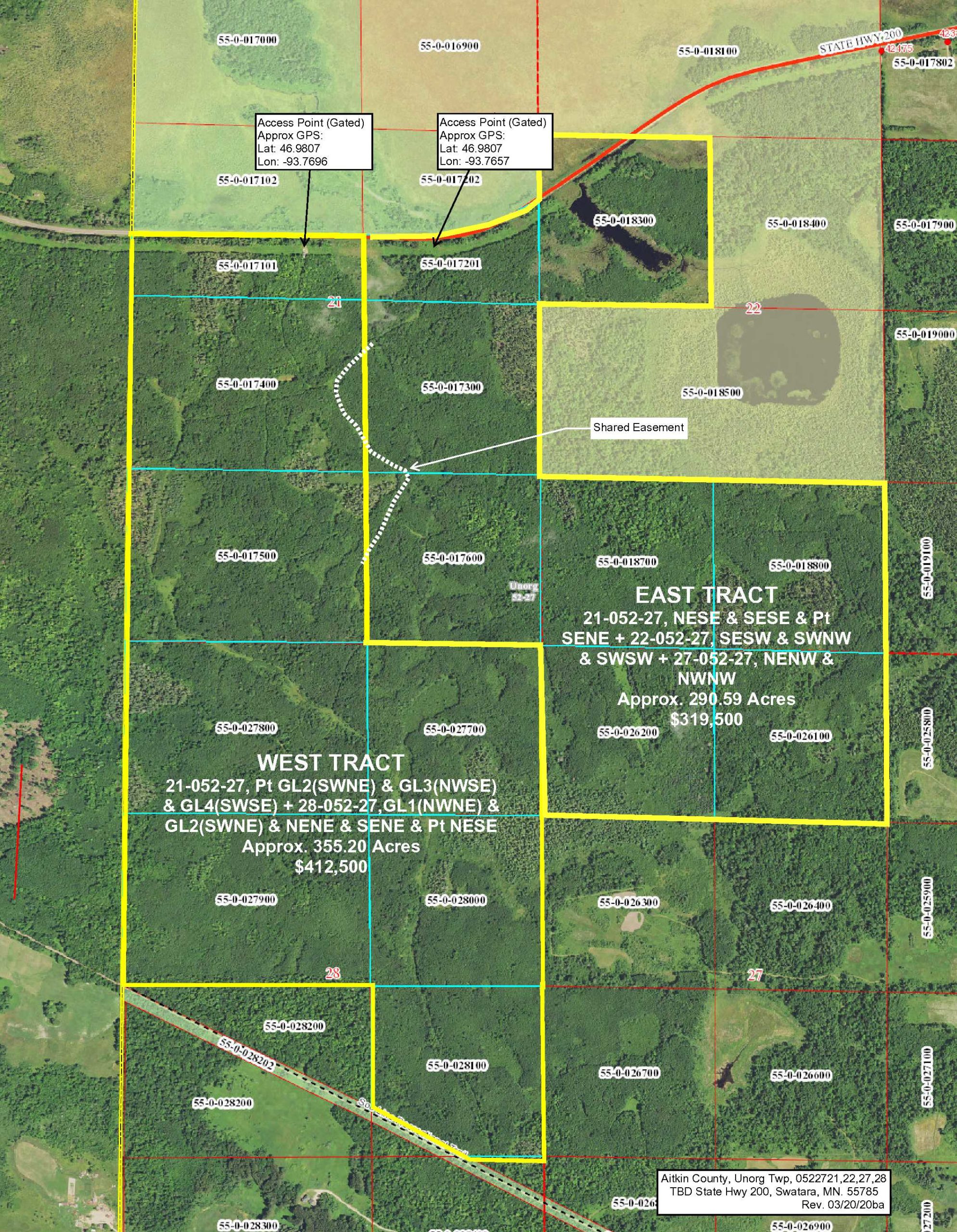
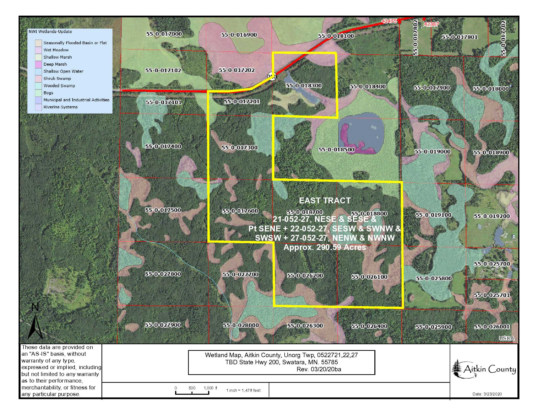
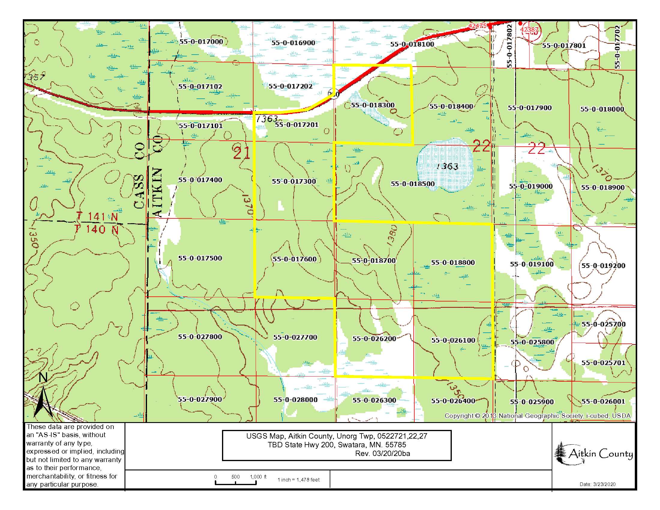
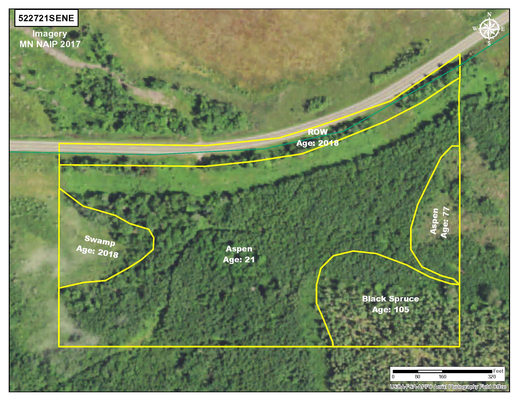
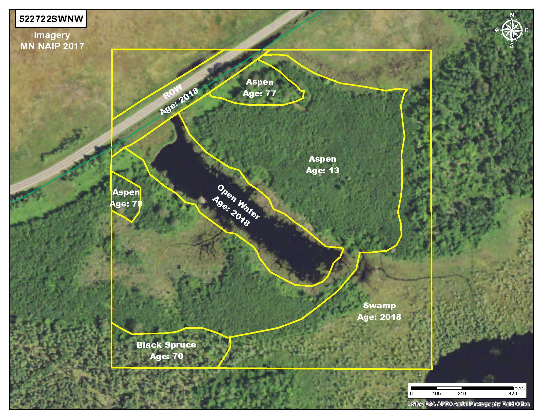
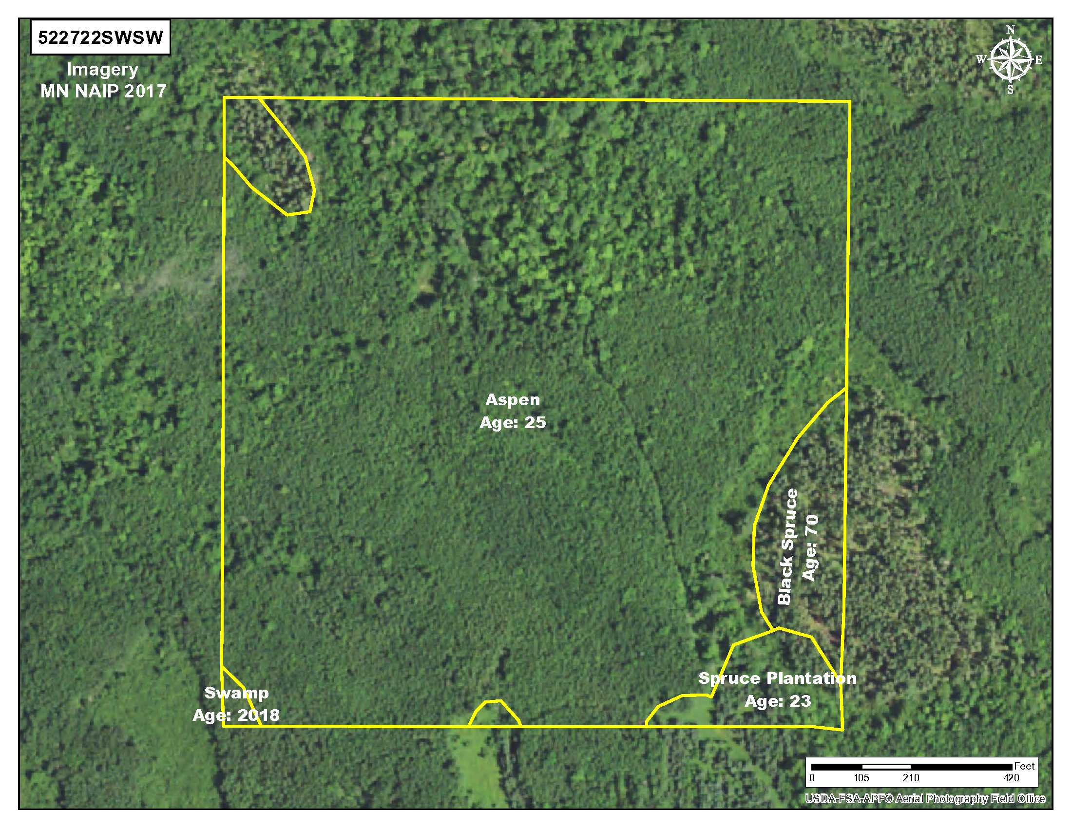
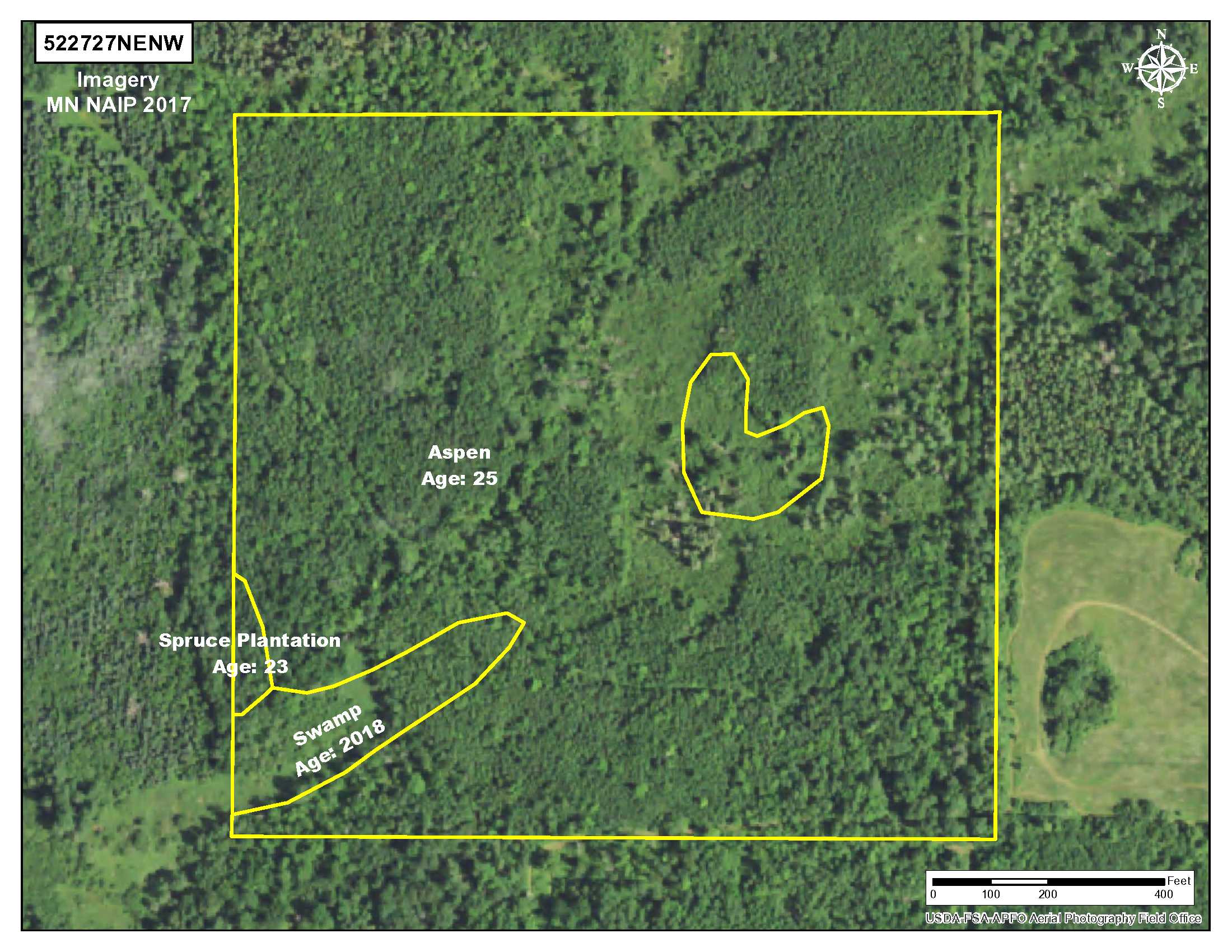
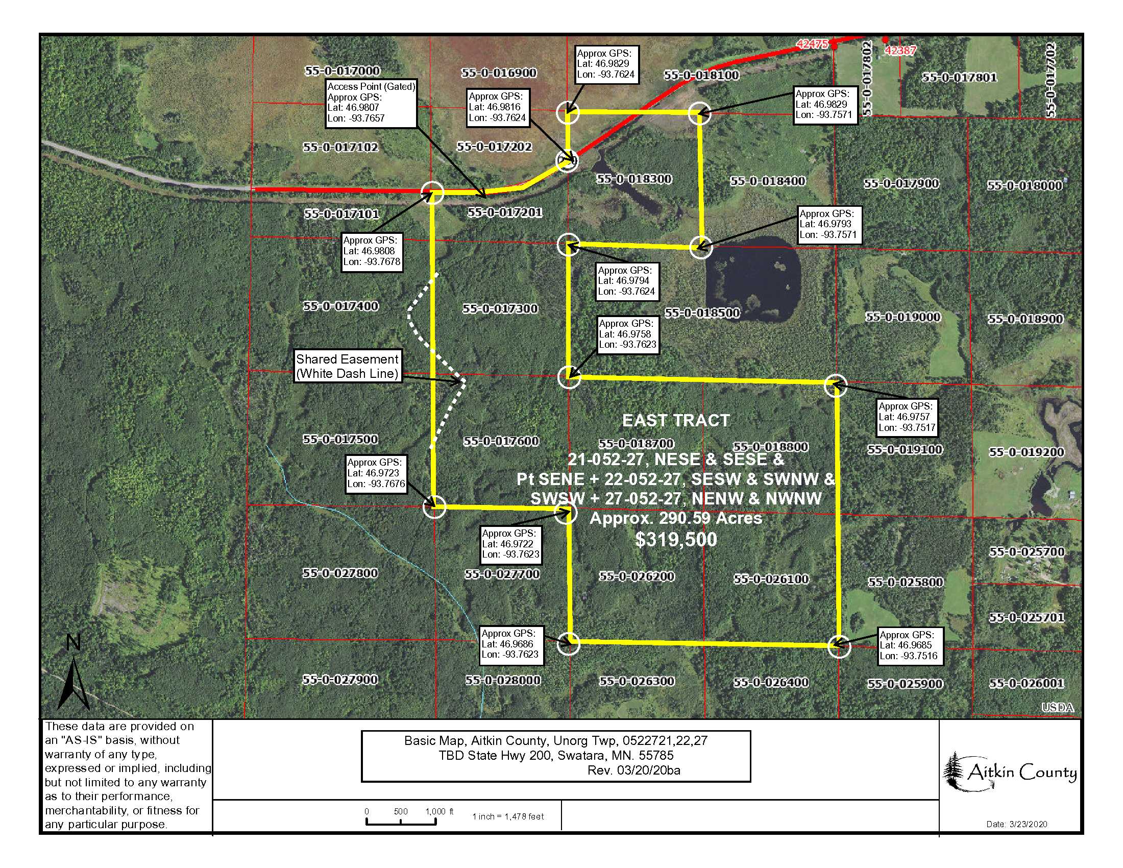
This beautiful 290-acre tract of PotlatchDeltic-owned land is 7+ miles west of Hill City. The gently rolling topography is largely upland accented by small and large wetland areas making for perfect wildlife habitat. There is a variety of timber on the property, easy access via an existing gated trail off paved State Hwy 200 and public land on the north side of the highway that connects to thousands of acres of Hill River State Forest for additional hunting and recreational space. The property is located near Hill City and Swatara. There’s good fishing nearby to the north on Holy Water Lake and DNR boat access on Taylor Lake, Hill South Basin and Hill North Basin lakes to the west. Taylor Lake has both brook and rainbow trout. Also nearby are the Soo Line Recreation Trail, Little Hill River WMA, Morrison Brook AMA and 3 snowmobile trails. This is an excellent opportunity for you and your hunting group to own a large tract of remote hunting land right off Hwy 200!
Main Property Info
55-0-017300, 55-0-017600, 55-0-017201, 55-0-018800, 55-0-018300, 55-0-018700, 55-0-026100, 55-0-026200
5543869
Sold
$319,500
$319,500
290.95
Open
Swatara
Unorg (052-27) Twp
MN
55785
Aitkin
0522721,NESE,SESE,PtSENE+0522722,SESW,SWNW,SWSW+0522727,NENW,NWNW. Subject to any easements, restrictions, or reservations of record. Easements granted and reserved/retained will include terms governing shared use of the easements.
Property Location
From the intersection of State Hwy 169 and State Hwy 200 in Hill City, go west on State Hwy 200 for 7.7 miles to trail with gate on the left. (South). Approx GPS Access Point: 46.9807, -93.7657.
Access trail off of paved State Hwy #200. (Approx GPS Access Point: 46.9807, -93.7657.) Gated.
Coordinates to approximate corners/points based on county mapping: NW: 46.9808, -93.7678 NE: 46.9829, -93.7571 SE: 46.9685, -93.7516 SW: 46.9686, -93.7623
East Tract, TBD State Hwy #200, Swatara, MN 55785
Hill City - 2
Property Details
0
0
214
2786’ X 5430’ X 4244’ X 3096’ (Irregular)
Utilities
Unknown
None
Lake Country Power (1-800-421-9959)
Waterfront
None
None
None
N/A
Taxes & Fees
No
$0
N/A
$2,558
0
$2,558
No
N/A
2020
Other Details
21, 22 & 27
052
27
74
26
Additional Comments
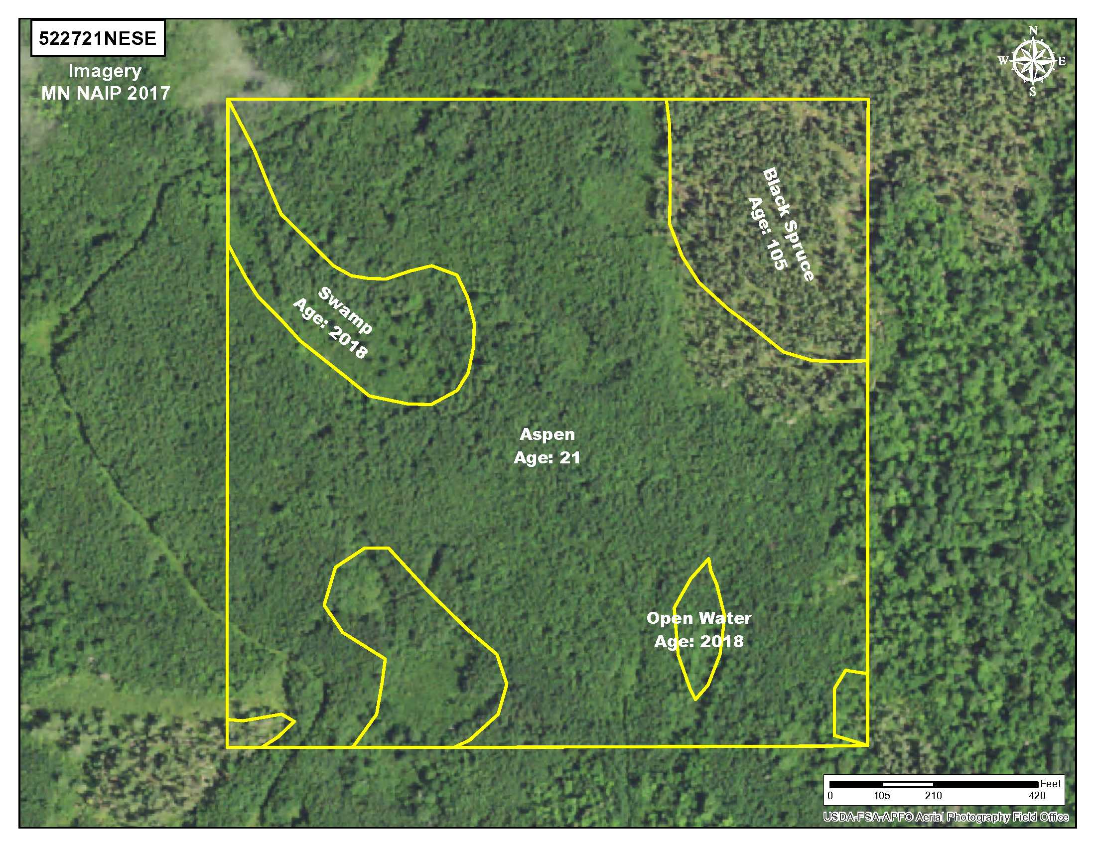
13 to 77-yr old Aspen, 70 to 105-yr old Black Spruce, 23-yr old Spruce Plantation & 150-yr old Tamarack. This property has been managed according to Forest Stewardship Council (FSC) standards. If Timber value is important to you, seek the advice of a competent forester to determine species, volumes and values.
Deer Permit Area: 171
Trail is gated at State Hwy 200; contact agent for instructions on viewing the property. Easement(s) affect this property. Shared easements affect this property and easements granted and reserved/retained will include terms governing shared use of the easements. See legal description and maps for details. Acreage, dimensions, and taxes estimated based on county data and mapping or seller data; county disclaimers included by reference; subject to split approval if necessary. Not surveyed. Photos/maps and GPS coordinates for convenience only and not guaranteed; physically inspect prior to purchase. Any deer stands on the land are not property of seller and are not included in sale. Use seller-approved PA and Addendum; closing dates the 3rd Wednesday each month. Seller is Potlatch Minnesota Timberlands LLC, a business entity under the laws of the State of Delaware.


