
MLS Number : 4643011
Sold $49,500 - Hunting & Recreation
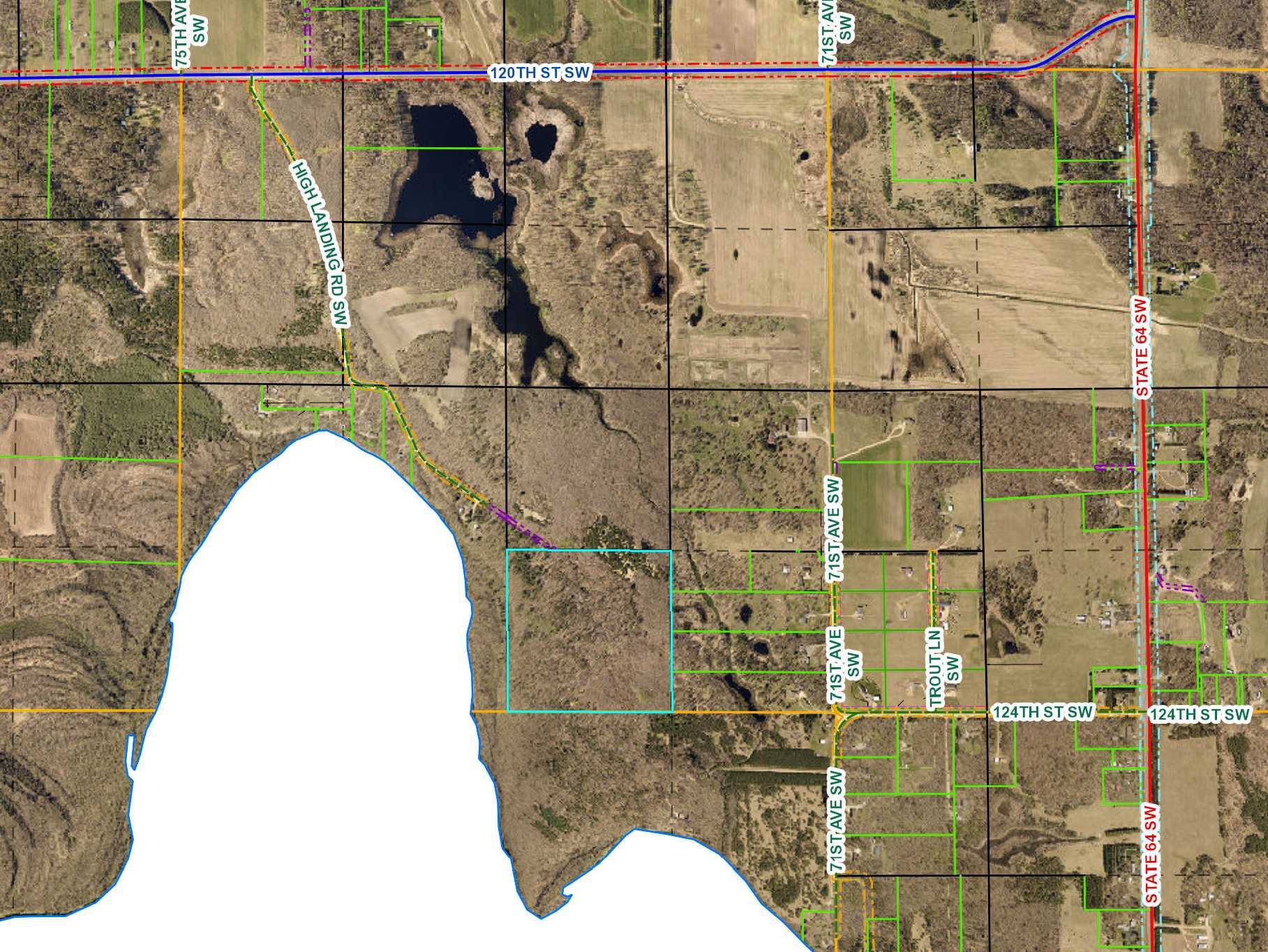
BACK ON MARKET! Potlatch land by the Crow Wing River northwest of Motley. Level upland terrain wooded with red pine, jack pine, aspen, and oak. Access via easement trails from High Landing Rd SW. Remote location for hunting less than 5 miles from US Hwy 10 in Motley. Public access to the river for fishing, canoeing, and tubing also in Motley.
Main Property Info
Property ID
031012200
031012200
MLS Number
4643011
4643011
Status
Sold
Sold
List Price
$54,900
$54,900
Selling Price
$49,500
$49,500
Acres
40.19
40.19
Zoning
Shoreland & Rural Res 2.5
Shoreland & Rural Res 2.5
City
Motley
Motley
Township
Becker Twp
Becker Twp
State
MN
MN
Zip Code
56466
56466
County
Cass
Cass
Legal Description
SWSE, 1-133-32. Together with easement in Doc 615676 and easement over NWSE. Subject to any easements, restrictions, or reservations of record.
SWSE, 1-133-32. Together with easement in Doc 615676 and easement over NWSE. Subject to any easements, restrictions, or reservations of record.
Property Location
Directions
From State Hwys 210 & 64 northeast of Motley, north on State Hwy 64 for 2 miles. Left on CR 33 (120th St SW) 1 4/10 miles. Left on High Landing Rd SW 1/2 mile. Left to stay on High Landing Rd SW 3/10 mile. Cont straight on easement trail approx 2/10 mile into north side of prop.
From State Hwys 210 & 64 northeast of Motley, north on State Hwy 64 for 2 miles. Left on CR 33 (120th St SW) 1 4/10 miles. Left on High Landing Rd SW 1/2 mile. Left to stay on High Landing Rd SW 3/10 mile. Cont straight on easement trail approx 2/10 mile into north side of prop.
Access
Access is via easement in Doc A000615676 and easement over existing trail through NWSE.
Access is via easement in Doc A000615676 and easement over existing trail through NWSE.
GPS Coordinates
Coordinates to flagged approx corners: NW corner = 46.3586, -94.6639; NE corner = 46.3586, -94.6587; SE corner = 46.3550, -94.6586; SW corner = 46.3550, -94.6639.
Coordinates to flagged approx corners: NW corner = 46.3586, -94.6639; NE corner = 46.3586, -94.6587; SE corner = 46.3550, -94.6586; SW corner = 46.3550, -94.6639.
Address
High Landing Rd SW
High Landing Rd SW
School District
Staples-Motley - 2170
Staples-Motley - 2170
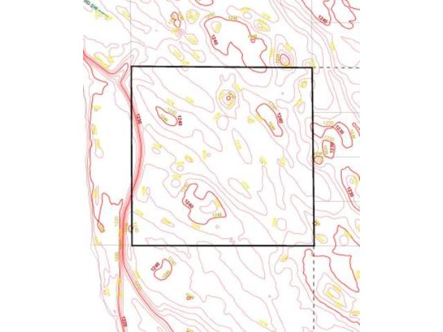
Property Details
Dimensions (approx)
1320 x 1320
1320 x 1320
Taxes & Fees
Tax Amount
$424
$424
Assessment Amount
0
0
Tax With Assessments
$424
$424
Tax Year
2017
2017
Other Details
Section Number
1
1
Township Number
133
133
Range Number
32
32
Estimated Upland %
99
99
Estimated Wetland %
1
1
Additional Comments
Timber Comments
This property has been managed according to Forest Stewardship Council (FSC) standards and is wooded with red pine, jack pine, aspen, and oak. If timber value is important to you, seek the advice of a competent forester to determine species, volumes and values.
This property has been managed according to Forest Stewardship Council (FSC) standards and is wooded with red pine, jack pine, aspen, and oak. If timber value is important to you, seek the advice of a competent forester to determine species, volumes and values.
Disclosures
Not surveyed; acreage and dimensions approximate based on county data and mapping; county disclaimers included by reference. Photos/maps for convenience only and not guaranteed; physically inspect prior to purchase. Any deer stands on the land are not property of seller and are not included in sale. Use seller-approved PA and addendum; closing dates the 2nd Wednesday each month.
Not surveyed; acreage and dimensions approximate based on county data and mapping; county disclaimers included by reference. Photos/maps for convenience only and not guaranteed; physically inspect prior to purchase. Any deer stands on the land are not property of seller and are not included in sale. Use seller-approved PA and addendum; closing dates the 2nd Wednesday each month.


