
MLS Number : 4859870
Sold $61,000 - Hunting & Recreation
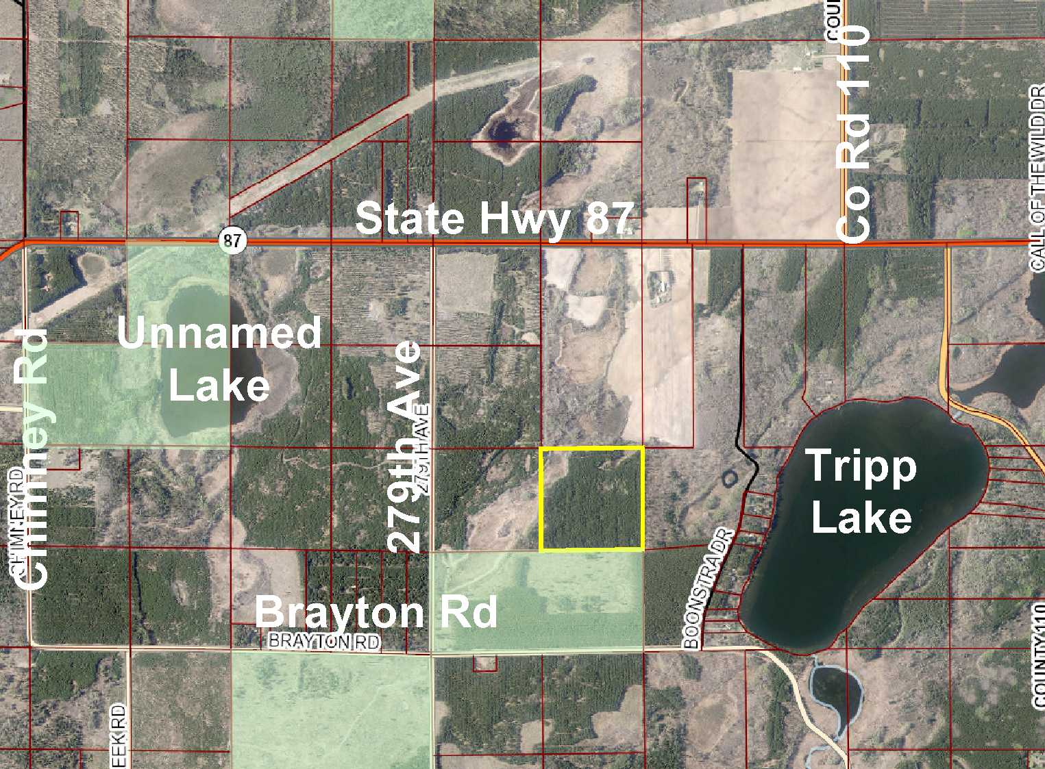
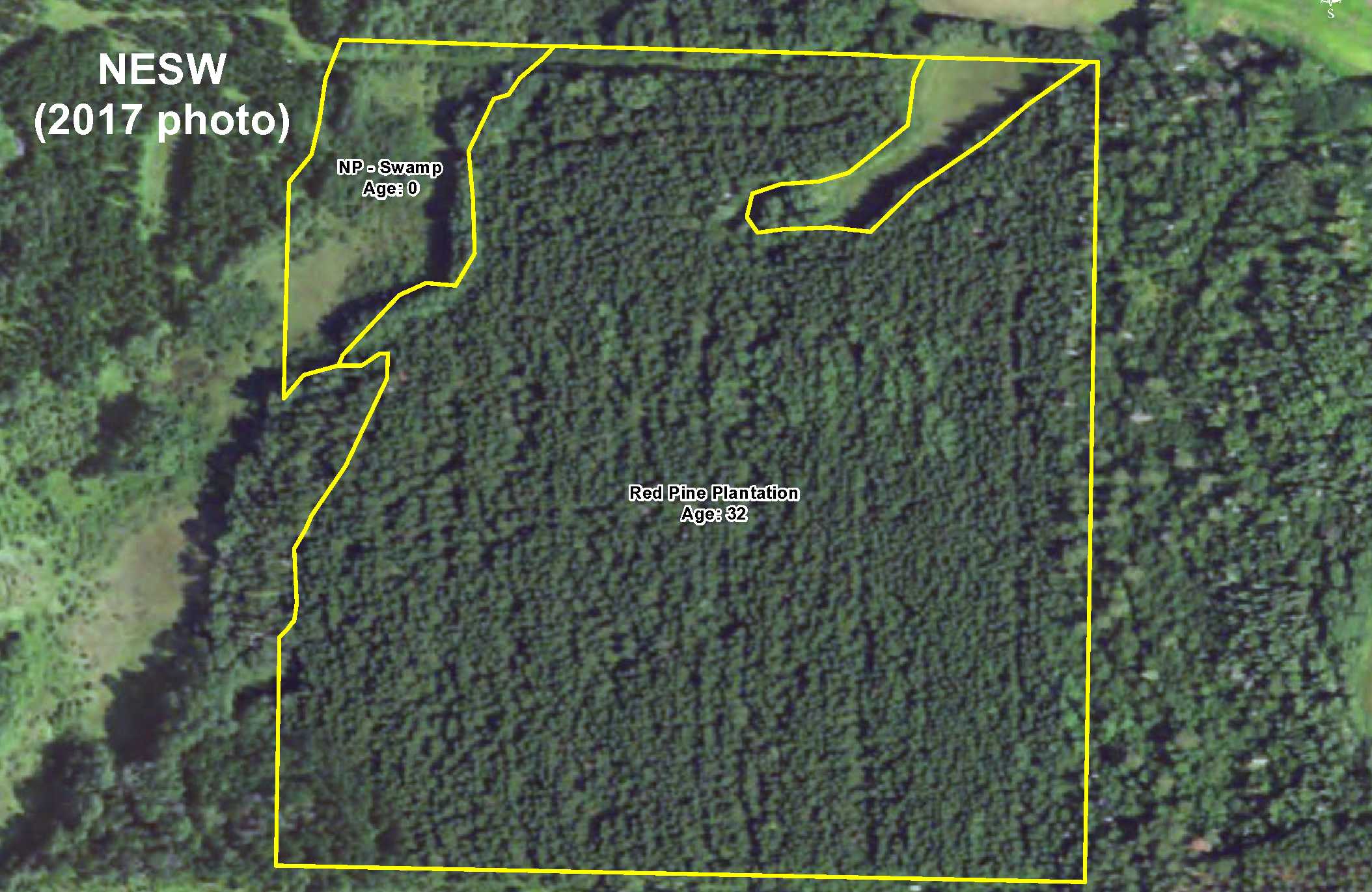
Potlatch land by Tripp Lake south of Akeley and Nevis. Upland wooded with red pine plantation slopes toward small wetland in the northwest corner. The red pine could offer potential future timber income. Access via an easement trail through public land adjoining the south side. The Crow Wing Chain WMA less than 2 miles to the west offers an additional 3,300+ acres of space for hunting deer, bear, small game, forest upland birds, and waterfowl.
Main Property Info
Property ID
031801300
031801300
MLS Number
4859870
4859870
Status
Sold
Sold
List Price
$68,900
$68,900
Selling Price
$61,000
$61,000
Acres
40
40
Zoning
not zoned
not zoned
City
Nevis
Nevis
Township
Badoura Twp
Badoura Twp
State
MN
MN
Zip Code
56467
56467
County
Hubbard
Hubbard
Legal Description
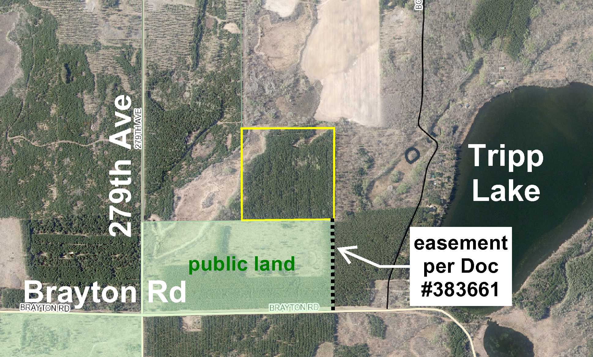
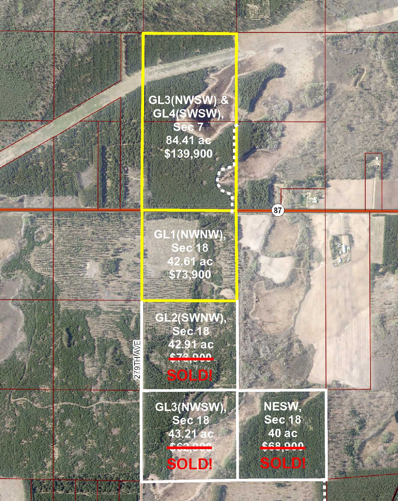
NESW, 18-139-32. Together with easement in Doc# 383661. Subject to any easements, restrictions, or reservations of record.
NESW, 18-139-32. Together with easement in Doc# 383661. Subject to any easements, restrictions, or reservations of record.
Property Location
Directions
From the intersection of State Hwy 64 and State Hwy 87 approx 10 miles south of Akeley, west on State Hwy 87 for 3 miles. Left on 279th Ave (aka Line Rd) 1 mile. Left on Brayton Rd 1/2 mile. Left on easement trail 1/4 mile to SE corner of the property. Continue north 1/10 mile and easement trail turns left and leads to center of the property.
From the intersection of State Hwy 64 and State Hwy 87 approx 10 miles south of Akeley, west on State Hwy 87 for 3 miles. Left on 279th Ave (aka Line Rd) 1 mile. Left on Brayton Rd 1/2 mile. Left on easement trail 1/4 mile to SE corner of the property. Continue north 1/10 mile and easement trail turns left and leads to center of the property.
Access
Access is via an easement trail through public land adjoining the south side of the property.
Access is via an easement trail through public land adjoining the south side of the property.
GPS Coordinates
Coordinates to approximate corners/points based on county mapping: SE corner where easement trail enters = 46.8512, -94.7767; SW corner = 46.8512, -94.7820; NW corner = 46.8549, -94.7820; NE corner = 46.8549, -94.7767; point where easement trail turns west into the property = 46.8531, -94.7767.
Coordinates to approximate corners/points based on county mapping: SE corner where easement trail enters = 46.8512, -94.7767; SW corner = 46.8512, -94.7820; NW corner = 46.8549, -94.7820; NE corner = 46.8549, -94.7767; point where easement trail turns west into the property = 46.8531, -94.7767.
Address
Brayton Rd
Brayton Rd
School District
Walker-Hackensack-Akeley - 113
Walker-Hackensack-Akeley - 113
Property Details
Dimensions (approx)
1320 x 1320 x 1320 x 1320
1320 x 1320 x 1320 x 1320
Utilities
Power Company
Itasca-Mantrap Co-op (1-888-713-3377)
Itasca-Mantrap Co-op (1-888-713-3377)
Taxes & Fees
Tax Amount
$334
$334
Assessment Amount
0
0
Tax With Assessments
$334
$334
Tax Year
2017
2017
Other Details
Section Number
18
18
Township Number
139
139
Range Number
32
32
Estimated Upland %
90
90
Estimated Wetland %
10
10
Additional Comments
Timber Comments
This property has been managed according to Forest Stewardship Council (FSC) standards. It is wooded with red pine that could offer potential future timber income. If timber value is important to you, seek the advice of a competent forester to determine species, volumes and values.
This property has been managed according to Forest Stewardship Council (FSC) standards. It is wooded with red pine that could offer potential future timber income. If timber value is important to you, seek the advice of a competent forester to determine species, volumes and values.
Hunting Comments
This property adjoins public land in MN Firearms Deer Zone 246.
This property adjoins public land in MN Firearms Deer Zone 246.
Disclosures
Not surveyed; acreage and dimensions approximate based on county data and mapping; county disclaimers included by reference. Photos/maps for convenience only and not guaranteed; physically inspect prior to purchase. Any deer stands on the land are not property of seller and are not included in sale. Use seller-approved PA and addendum; closing dates the 2nd Wednesday each month.
Not surveyed; acreage and dimensions approximate based on county data and mapping; county disclaimers included by reference. Photos/maps for convenience only and not guaranteed; physically inspect prior to purchase. Any deer stands on the land are not property of seller and are not included in sale. Use seller-approved PA and addendum; closing dates the 2nd Wednesday each month.


