

MLS Number : 4957247
Sold $66,900 - Hunting & Recreation
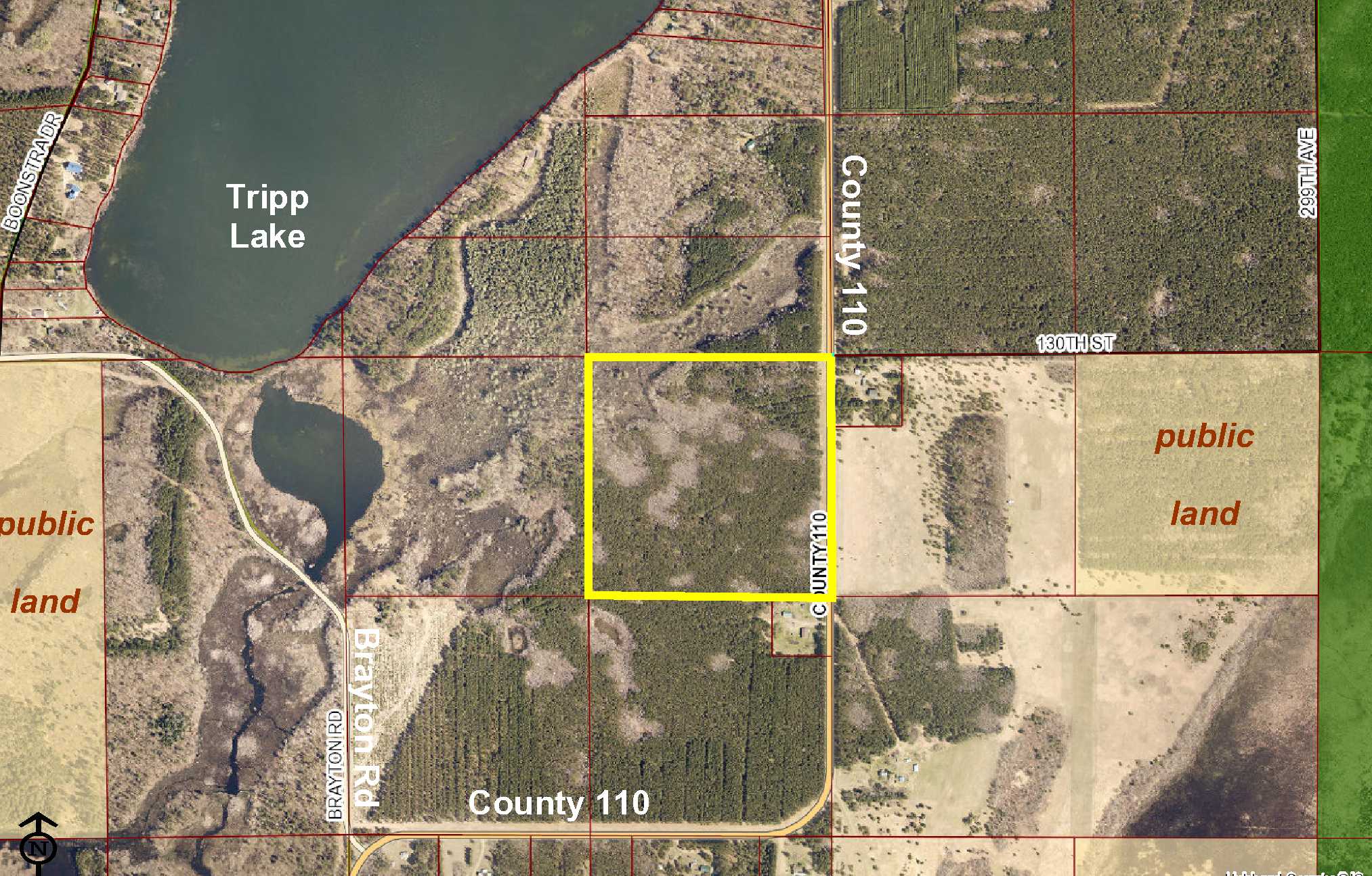
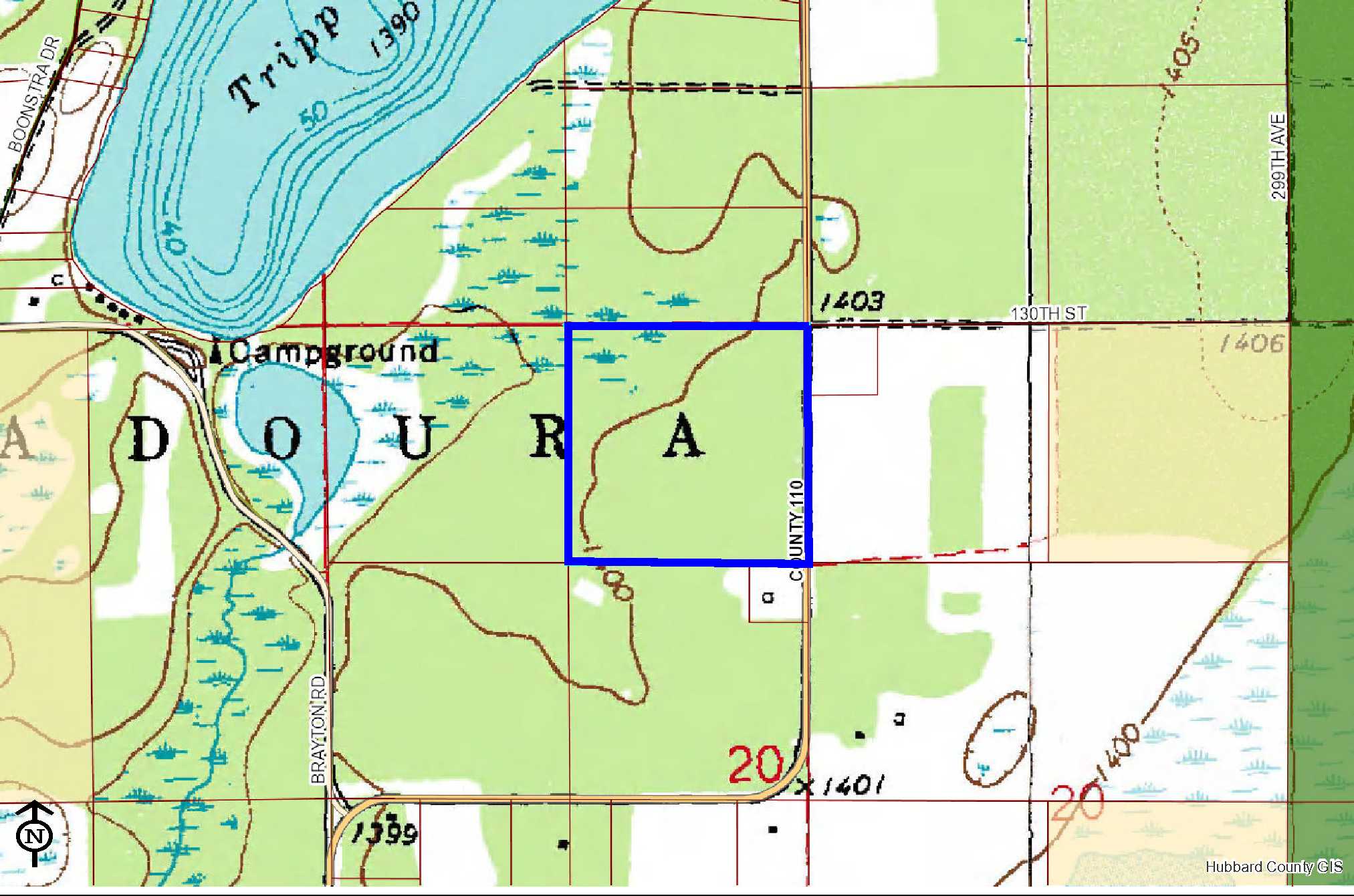
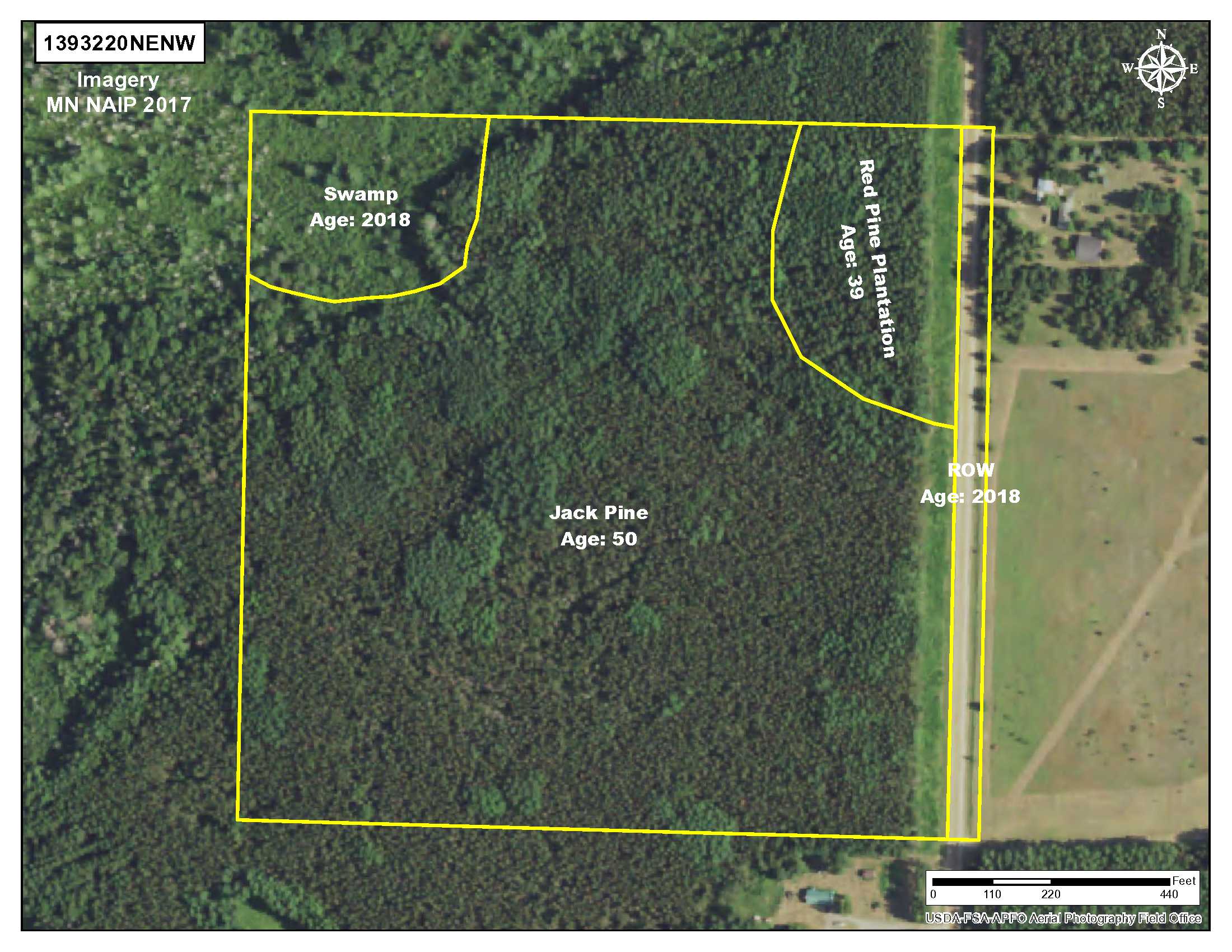
PotlatchDeltic land by Tripp Lake south of Akeley and Nevis. Level upland wooded with red pine and jack pine is accented by a small wetland in the northwest corner. Gravel county road along the east side for access. Public land Badoura State Forest land just over 1 mile away, and the Crow Wing Chain WMA only 5 miles west offers an additional 3,300+ acres of space for hunting deer, bear, small game, forest upland birds, and waterfowl. With a home across the road, utilities are available, so this could be a potential building site for a rural home or cabin.
Main Property Info
Property ID
032001400
032001400
MLS Number
4957247
4957247
Status
Sold
Sold
List Price
$66,900
$66,900
Selling Price
$66,900
$66,900
Acres
40
40
Zoning
not zoned
not zoned
City
Nevis
Nevis
Township
Badoura Twp
Badoura Twp
State
MN
MN
Zip Code
56467
56467
County
Hubbard
Hubbard
Legal Description
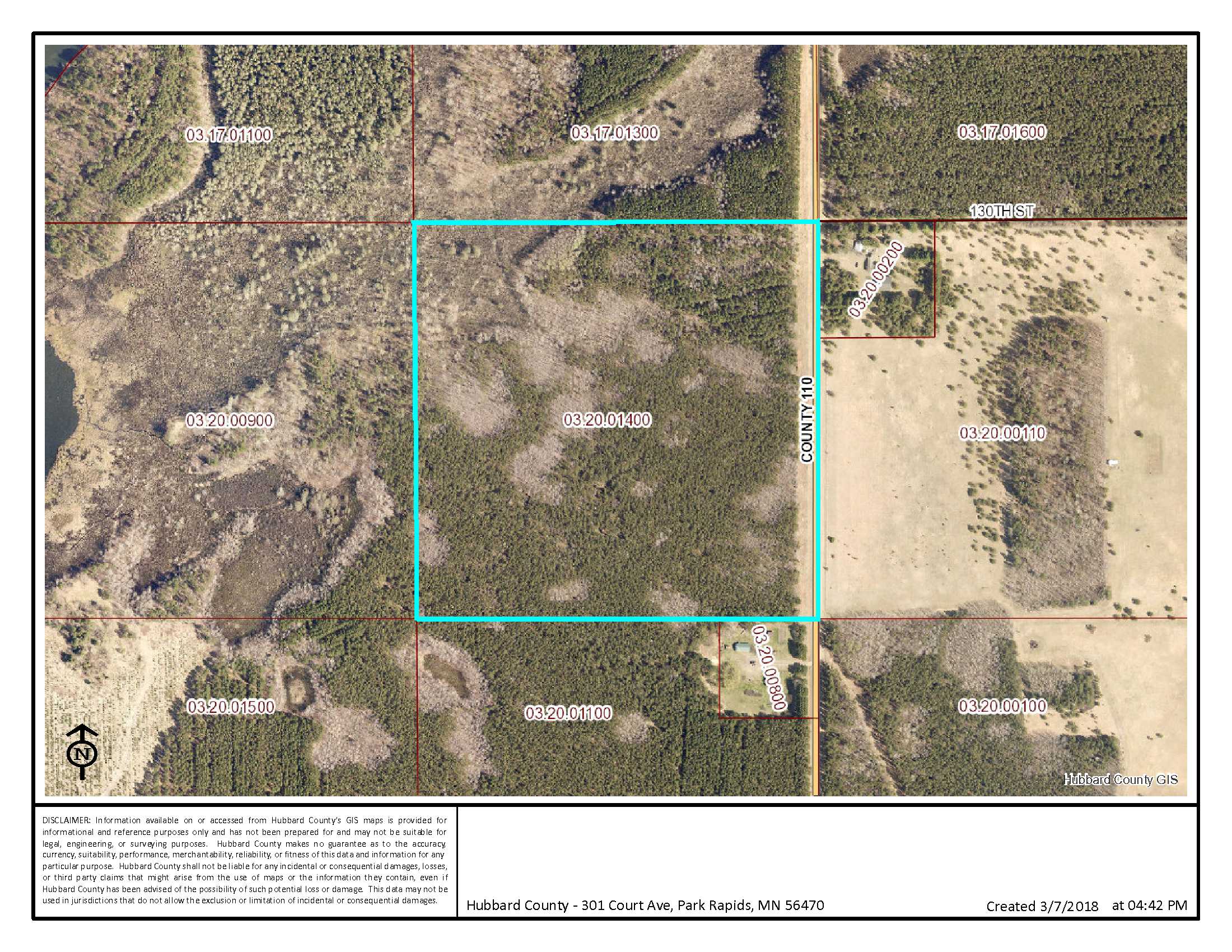
NENW, 20-139-32. Subject to County 110 and any other easements, restrictions, or reservations of record.
NENW, 20-139-32. Subject to County 110 and any other easements, restrictions, or reservations of record.
Property Location
Directions
From the intersection of State Hwy 64 and State Hwy 87 approx 10 miles south of Akeley, west on State Hwy 87 for 1.75 miles. Left on County 110 for 1.1 miles to northeast corner of the property (across from address #12990).
From the intersection of State Hwy 64 and State Hwy 87 approx 10 miles south of Akeley, west on State Hwy 87 for 1.75 miles. Left on County 110 for 1.1 miles to northeast corner of the property (across from address #12990).
Access
Gravel County 110 is along the east side of the property.
Gravel County 110 is along the east side of the property.
GPS Coordinates
Coordinates to flagged approximate corners/points: NE corner along County 110 = 46.8477, -94.7552; SE corner along County 110 = 46.8440, -94.7552; SW corner = 46.8440, -94.7606; NW corner = 46.8477, -94.7606.
Coordinates to flagged approximate corners/points: NE corner along County 110 = 46.8477, -94.7552; SE corner along County 110 = 46.8440, -94.7552; SW corner = 46.8440, -94.7606; NW corner = 46.8477, -94.7606.
Address
County 110
County 110
School District
Walker-Hackensack-Akeley - 113
Walker-Hackensack-Akeley - 113
Property Details
Dimensions (approx)
1320 x 1320 x 1320 x 1320
1320 x 1320 x 1320 x 1320
Utilities
Power Company
Itasca-Mantrap Co-op (1-888-713-3377)
Itasca-Mantrap Co-op (1-888-713-3377)
Taxes & Fees
Tax Amount
$420
$420
Tax Year
2019
2019
Other Details
Section Number
20
20
Township Number
139
139
Range Number
32
32
Estimated Upland %
90
90
Estimated Wetland %
10
10
Additional Comments
Timber Comments
This property has been managed according to Forest Stewardship Council (FSC) standards and is wooded with red pine and jack pine. If timber value is important to you, seek the advice of a competent forester to determine species, volumes and values.
This property has been managed according to Forest Stewardship Council (FSC) standards and is wooded with red pine and jack pine. If timber value is important to you, seek the advice of a competent forester to determine species, volumes and values.
Hunting Comments
This property adjoins public land in MN Firearms Deer Zone 246.
This property adjoins public land in MN Firearms Deer Zone 246.
Disclosures
Not surveyed; acreage and dimensions approximate based on county data and mapping; county disclaimers included by reference. Photos/maps for convenience only and not guaranteed; physically inspect prior to purchase. Any deer stands on the land are not property of seller and are not included in sale. Use seller-approved PA and addendum; closing dates the 3rd Wednesday each month. In addition to mineral rights being retained by the State of Minnesota, mineral rights are also retained by a third party.
Not surveyed; acreage and dimensions approximate based on county data and mapping; county disclaimers included by reference. Photos/maps for convenience only and not guaranteed; physically inspect prior to purchase. Any deer stands on the land are not property of seller and are not included in sale. Use seller-approved PA and addendum; closing dates the 3rd Wednesday each month. In addition to mineral rights being retained by the State of Minnesota, mineral rights are also retained by a third party.


