
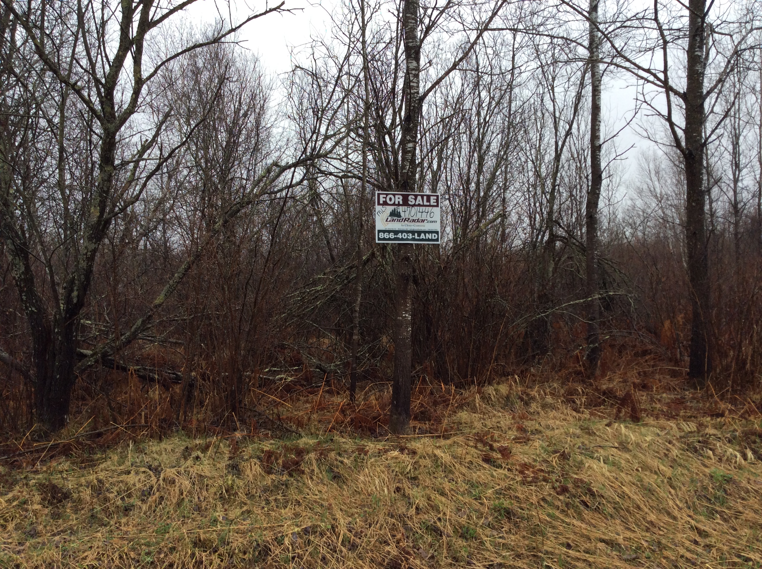


MLS Number : 4701446
Sold $39,900 - Hunting & Recreation, Price Reduced
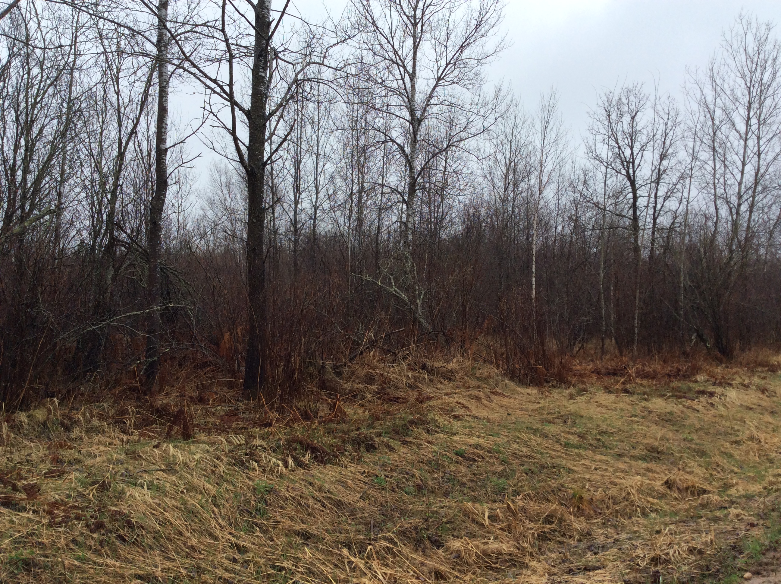
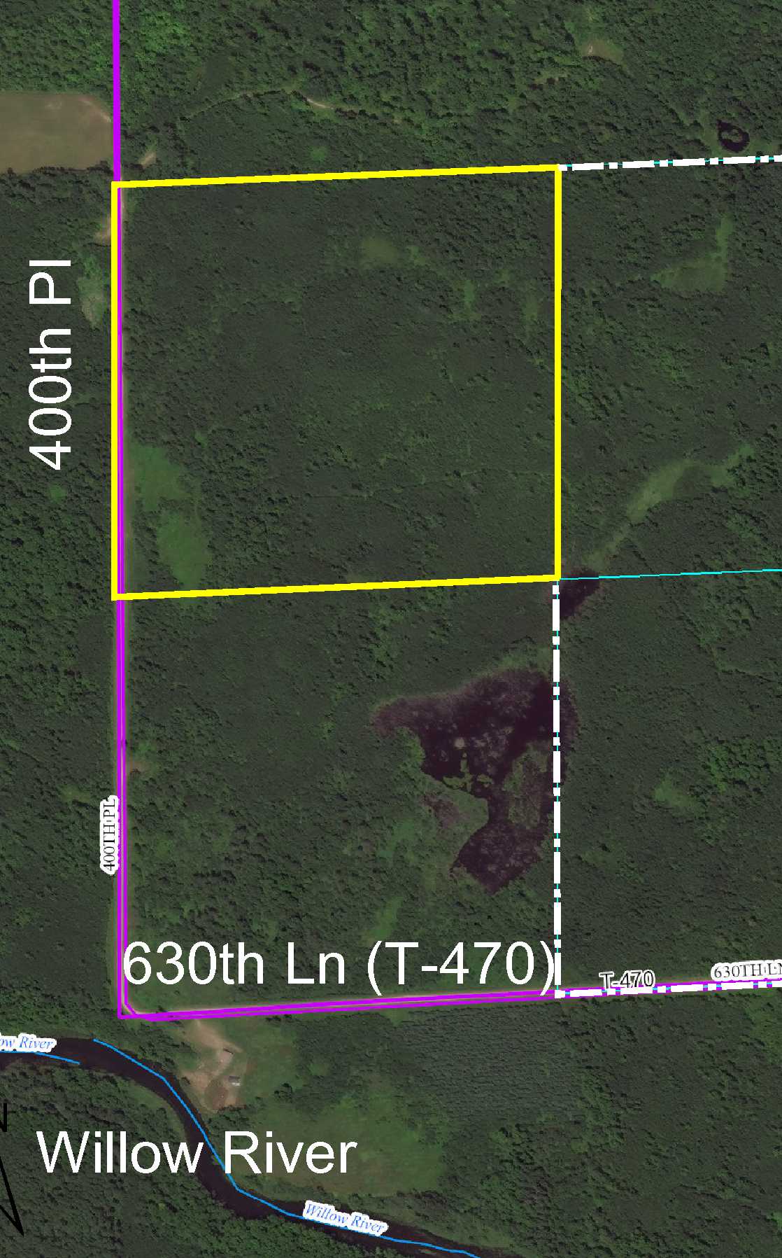
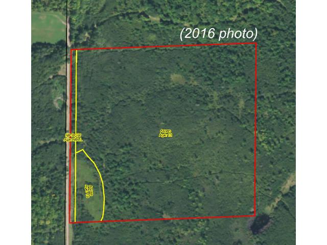
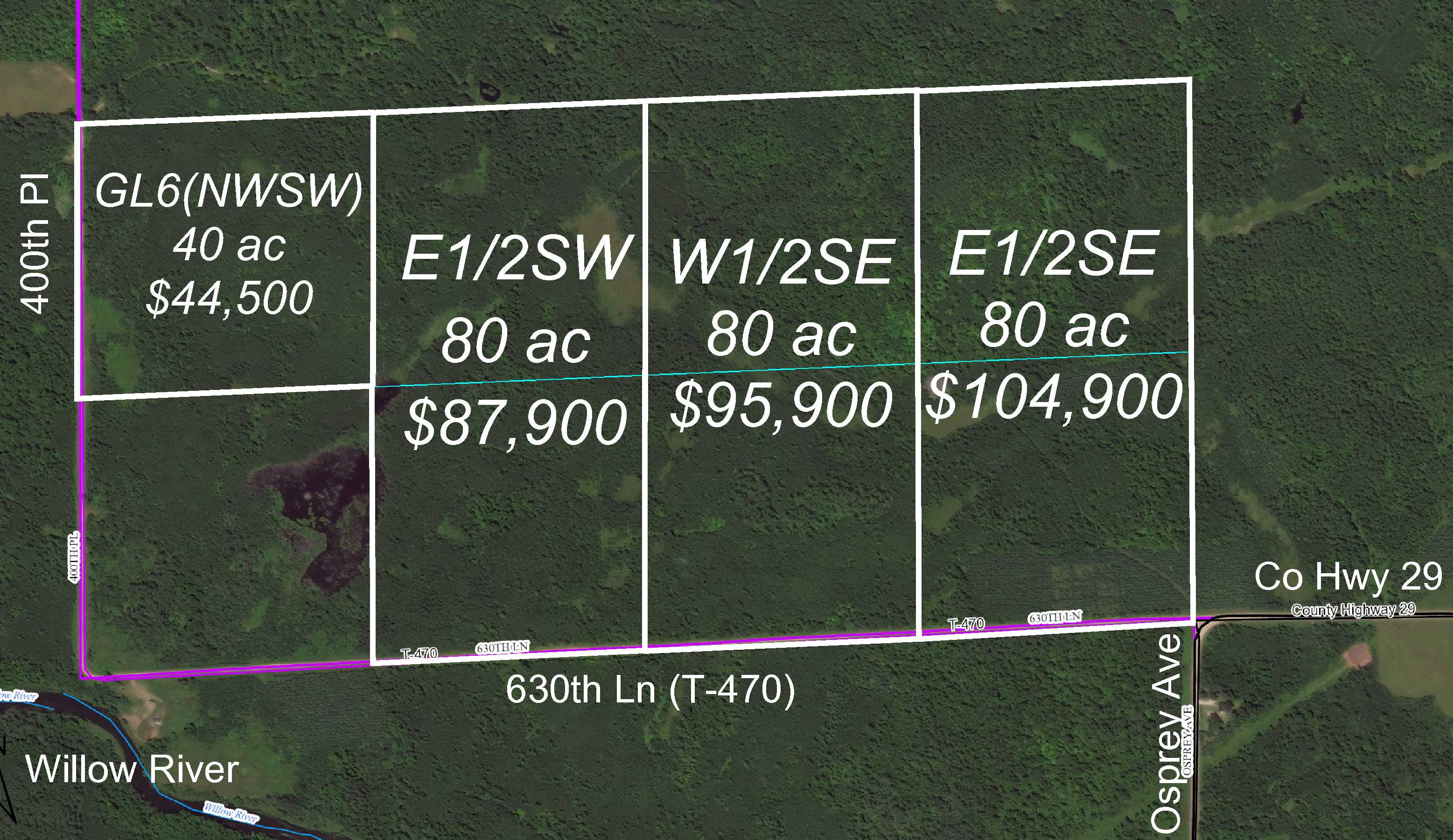
Price lowered from $49,900 to $44,500! Remote Potlatch acreage by the Willow River and Swatara southwest of Hill City. Sloped upland terrain is wooded with aspen and accented with bands of wetland along the west and north. Gravel township road provides access along the west boundary. Hundreds of acres of public land connecting to hundreds more acres of public Hill River State Forest land is just over 1 mile away for additional hunting and recreational space.
Main Property Info
Property ID
200009000
200009000
MLS Number
4701446
4701446
Status
Sold
Sold
List Price
$44,500
$44,500
Selling Price
$39,900
$39,900
Acres
43.700
43.700
Zoning
Open (see zoning standards in Supplements)
Open (see zoning standards in Supplements)
City
Swatara
Swatara
Township
Macville Twp
Macville Twp
State
MN
MN
Zip Code
55785
55785
County
Aitkin
Aitkin
Legal Description
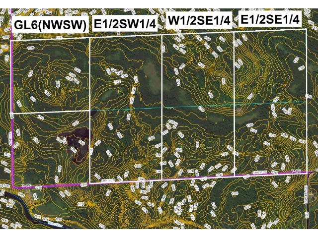
GL6(NWSW), 6-051-26. Subject to 400th Pl and any easements, restrictions, or reservations of record.
GL6(NWSW), 6-051-26. Subject to 400th Pl and any easements, restrictions, or reservations of record.
Property Location
Directions
From the intersection of US Hwy 169 and State Hwy 200 in Hill City, west on State Hwy 200 for 3 miles. Left (south and west) on Co Rd 29 (Osprey Ave) 4 1/2 miles. Straight on 630th Ln 1 mile. Right (north) on 400th Pl 1/4 mile to SW corner of the tract. (400th Pl continues along the west boundary of
From the intersection of US Hwy 169 and State Hwy 200 in Hill City, west on State Hwy 200 for 3 miles. Left (south and west) on Co Rd 29 (Osprey Ave) 4 1/2 miles. Straight on 630th Ln 1 mile. Right (north) on 400th Pl 1/4 mile to SW corner of the tract. (400th Pl continues along the west boundary of
Access
Access is via 400th Pl, a gravel township road, along the south boundary.
Access is via 400th Pl, a gravel township road, along the south boundary.
GPS Coordinates
Coordinates to approx corners based on Google Earth mapping: SW corner along 400th Pl = 46.9324, -93.6996; NW corner along 400th Pl = 46.9360, -93.6996; NE corner = 46.9362, -93.6939; SE corner = 46.9325, -93.6938.
Coordinates to approx corners based on Google Earth mapping: SW corner along 400th Pl = 46.9324, -93.6996; NW corner along 400th Pl = 46.9360, -93.6996; NE corner = 46.9362, -93.6939; SE corner = 46.9325, -93.6938.
Address
GL6(NWSW) 400th Place
GL6(NWSW) 400th Place
School District
Hill City - 2
Hill City - 2
Property Details
Dimensions (approx)
1320x1320x1320x1320
1320x1320x1320x1320
Utilities
Available Utilities
Electric
Electric
On Site Utilities
None
None
Power Company
Lake Country Power (1-800-421-9959)
Lake Country Power (1-800-421-9959)
Taxes & Fees
Association Fee
$0
$0
Tax Amount
$402
$402
Tax With Assessments
$402
$402
Tax Year
2016
2016
Other Details
Section Number
6
6
Township Number
051
051
Range Number
26
26
Estimated Upland %
60
60
Estimated Wetland %
40
40
Additional Comments
Timber Comments
This property has been managed according to Forest Stewardship Council (FSC) standards. Timber is aspen. If timber value is important to you, seek the advice of a competent forester to determine species, volumes and values.
This property has been managed according to Forest Stewardship Council (FSC) standards. Timber is aspen. If timber value is important to you, seek the advice of a competent forester to determine species, volumes and values.
Hunting Comments
This property is near public land in MN Firearms Deer Zone 171.
This property is near public land in MN Firearms Deer Zone 171.
Disclosures
Not surveyed; acreage and dimensions approximate based on county data and mapping; county disclaimers included by reference. Photos/maps for convenience only and not guaranteed; tree cover may be different than depicted; physically inspect prior to purchase. Any deer stands on the land are not property of seller and are not included in sale. Use seller-approved PA and addendum; closing dates the 2nd Wednesday each month.
Not surveyed; acreage and dimensions approximate based on county data and mapping; county disclaimers included by reference. Photos/maps for convenience only and not guaranteed; tree cover may be different than depicted; physically inspect prior to purchase. Any deer stands on the land are not property of seller and are not included in sale. Use seller-approved PA and addendum; closing dates the 2nd Wednesday each month.


