


MLS Number : 4951617
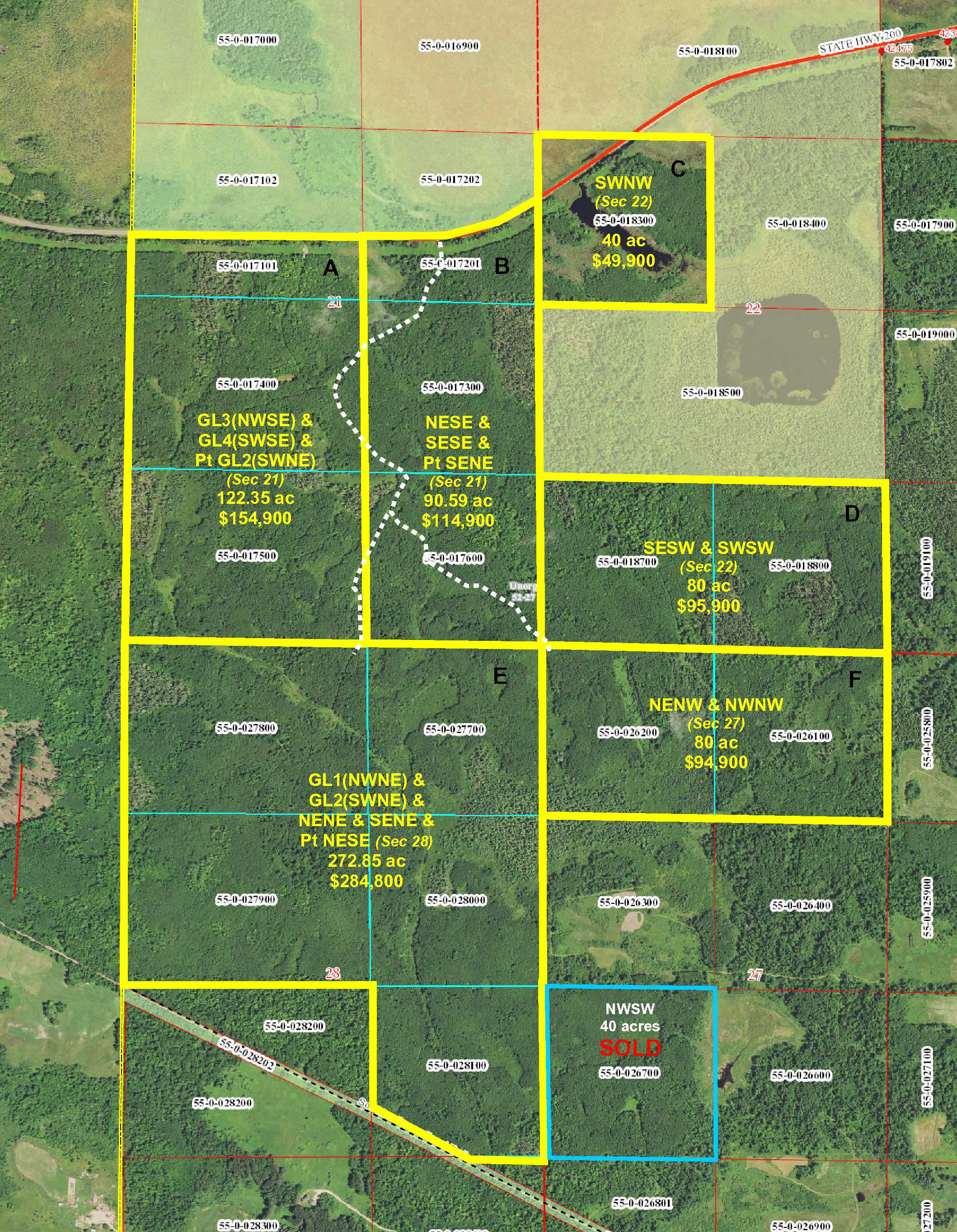
Sold $154,900 - Hunting & Recreation
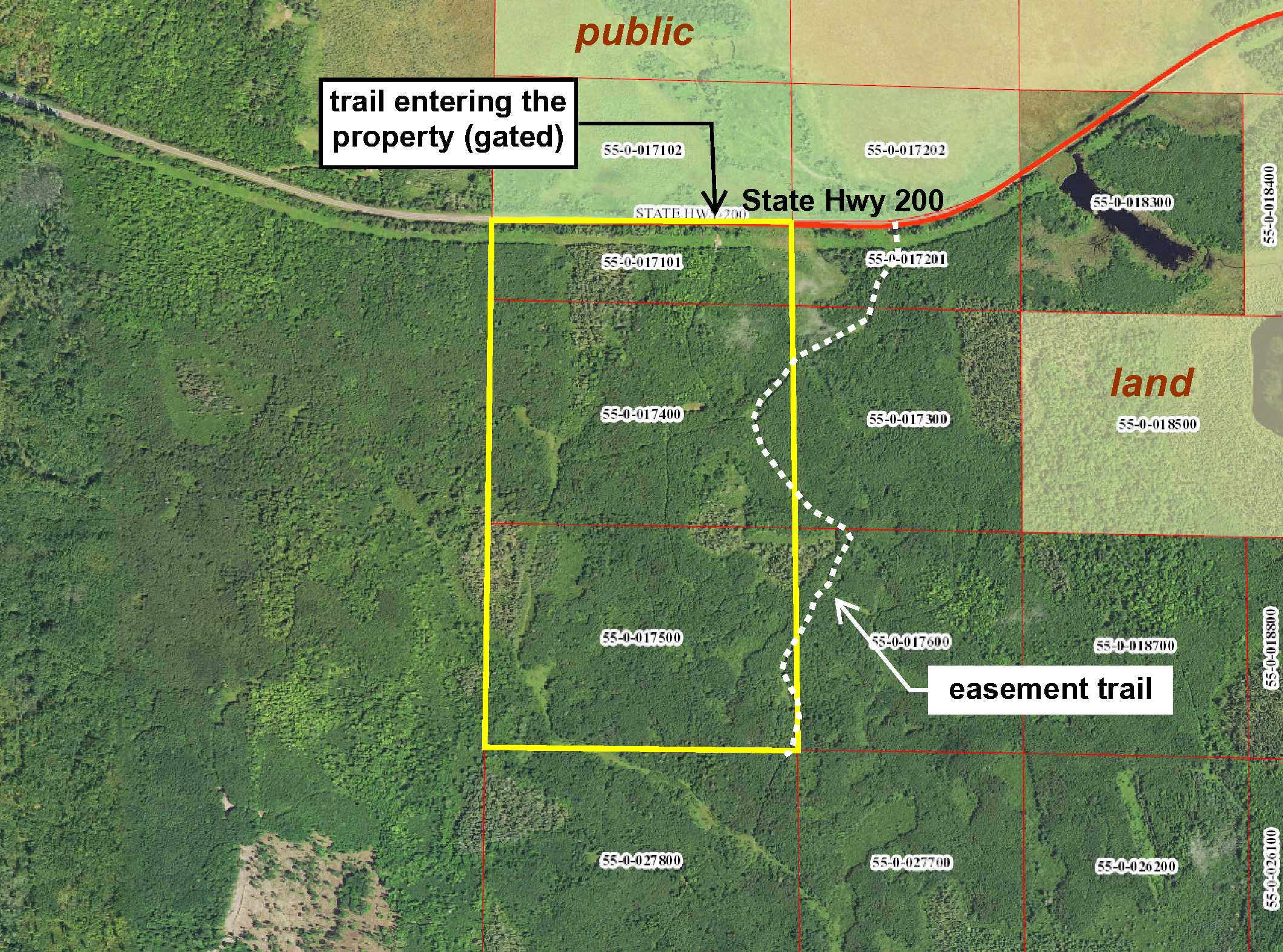
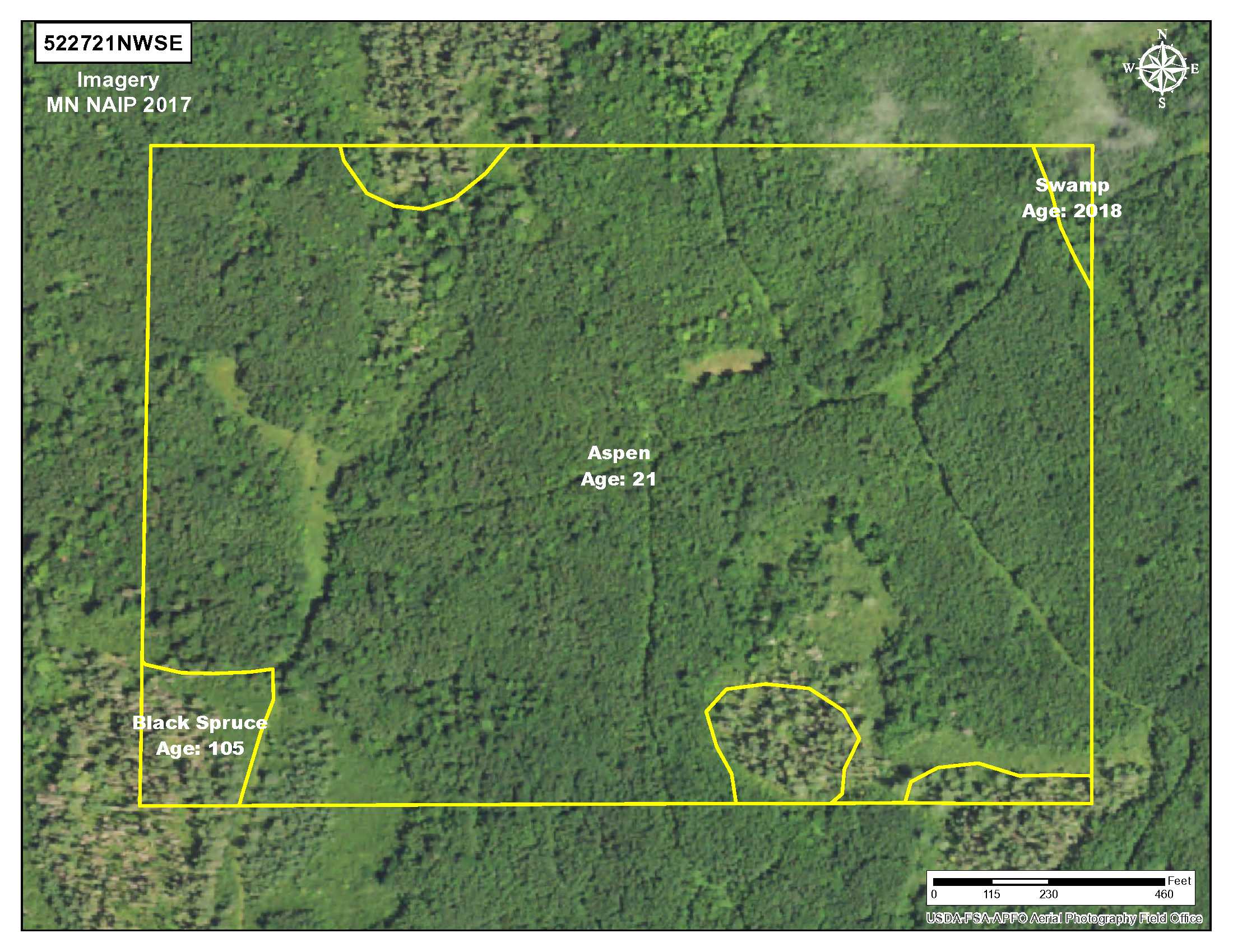
PotlatchDeltic land just outside of the Hill River State Forest west of Hill City. Fairly-level terrain wooded mostly with aspen along with some black spruce. Primarily upland with wetlands scattered throughout and approx 780 ft of creek/stream in the southwest corner. State Hwy 200 runs along the north side and a trail (gated) branches off to access interior parts of the acreage. Public land across the highway connects to thousands of acres of state forest land for expansive hunting and recreational space. Connection to Soo Line Trail for ATV riding and snowmobiling is approx 4 miles away in Shovel Lake.
Main Property Info
Property ID
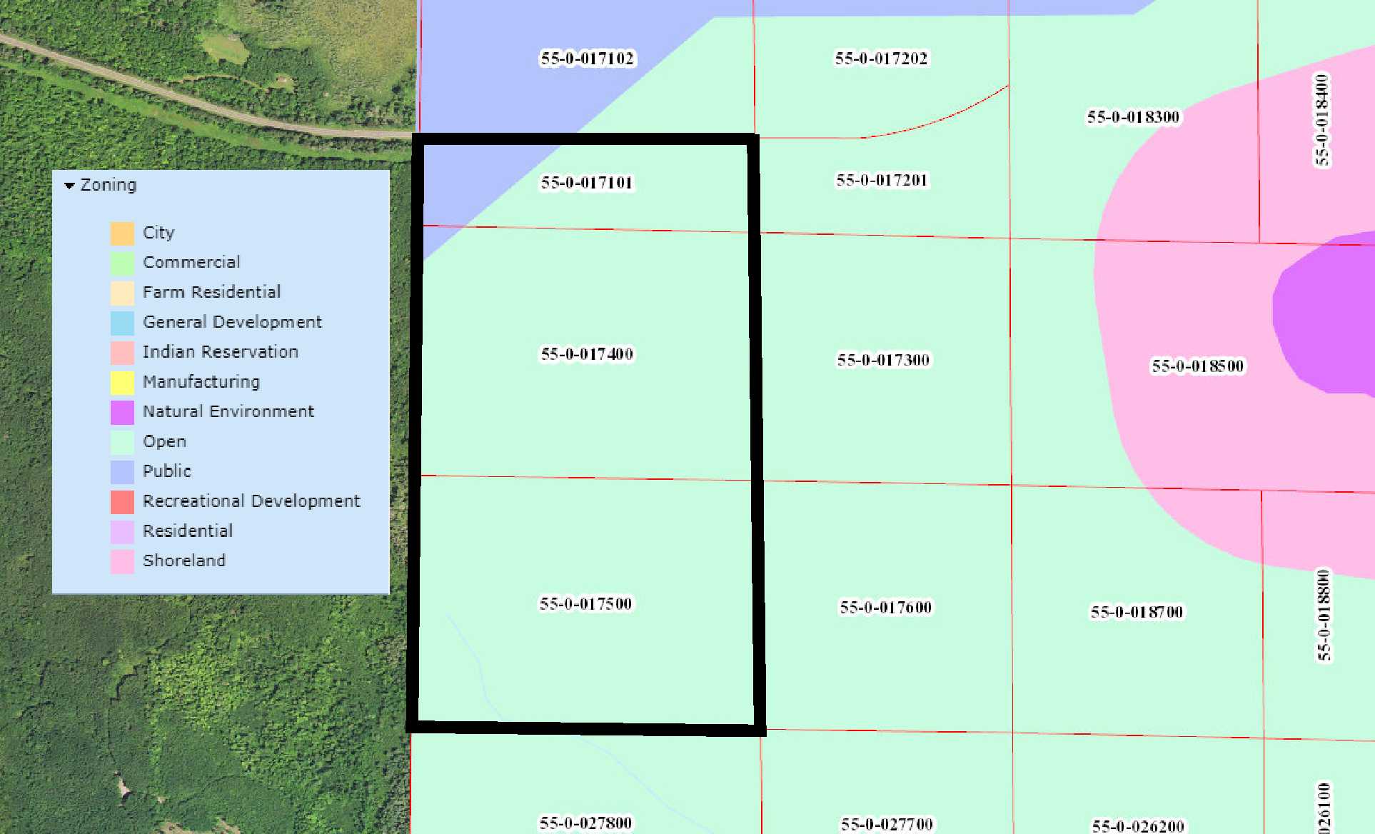
550017101 & 550017400 & 550017500
550017101 & 550017400 & 550017500
MLS Number
4951617
4951617
Status
Sold
Sold
List Price
$154,900
$154,900
Acres
122.35
122.35
Zoning
Open & General Development
Open & General Development
City
Swatara
Swatara
Township
Unorg (052-27) Twp
Unorg (052-27) Twp
State
MN
MN
Zip Code
55785
55785
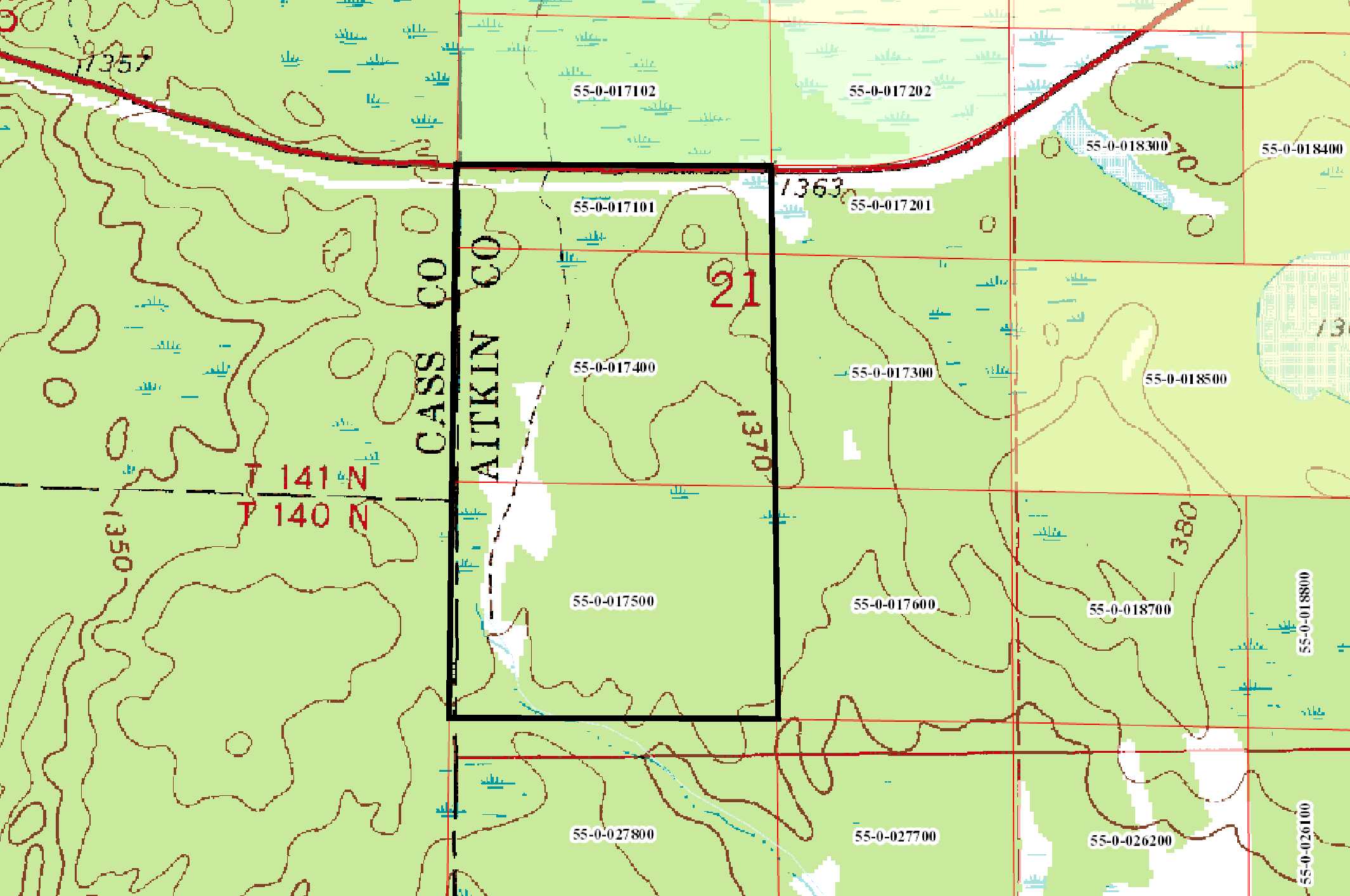
County
Aitkin
Aitkin
Legal Description
GL3(NWSE) & GL4(SWSE) & part of GL2(SWNE) lying south of State Hwy 200, 21-052-27. Subject to State Hwy 200, easements over existing trails, and any other easements, restrictions, or reservations of record.
GL3(NWSE) & GL4(SWSE) & part of GL2(SWNE) lying south of State Hwy 200, 21-052-27. Subject to State Hwy 200, easements over existing trails, and any other easements, restrictions, or reservations of record.
Property Location
Directions
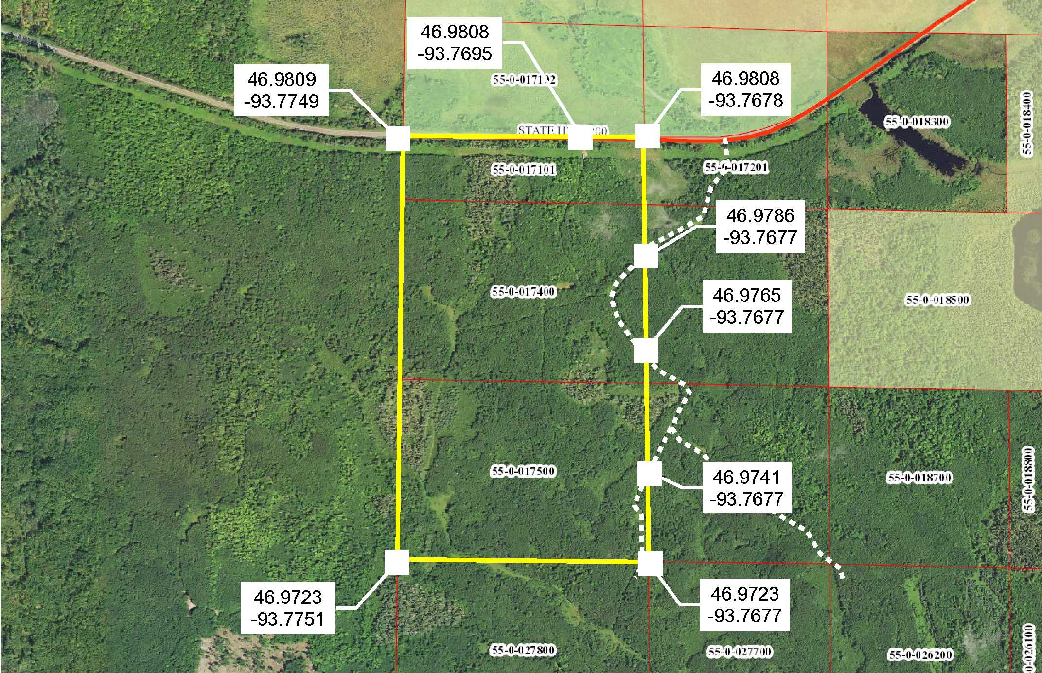
From the intersection of State Hwy 169 and State Hwy 200 in Hill City, west on State Hwy 200 for 7.8 miles to gated trail on the left entering the property.
From the intersection of State Hwy 169 and State Hwy 200 in Hill City, west on State Hwy 200 for 7.8 miles to gated trail on the left entering the property.
Access
State Hwy 200 is along the north side, and a trail enters the north side and branches off throughout the acreage. Trail is gated; contact agent for instructions on viewing the property.
State Hwy 200 is along the north side, and a trail enters the north side and branches off throughout the acreage. Trail is gated; contact agent for instructions on viewing the property.
GPS Coordinates
See map for coordinates to approximate corners/points based on county mapping.
See map for coordinates to approximate corners/points based on county mapping.
Address
State Hwy 200
State Hwy 200
School District
Hill City - 2
Hill City - 2
Property Details
Dimensions (approx)
1778 x 3124 x 1853 x 3118 IRR
1778 x 3124 x 1853 x 3118 IRR
Utilities
Power Company
Lake Country Power (1-800-421-9959)
Lake Country Power (1-800-421-9959)
Taxes & Fees
Tax Amount
$1,250
$1,250
Tax With Assessments
$1,250
$1,250
Tax Year
2019
2019
Other Details
Section Number
21
21
Township Number
052
052
Range Number
27
27
Estimated Upland %
75
75
Estimated Wetland %
25
25
Additional Comments
Timber Comments
This property has been managed according to Forest Stewardship Council (FSC) standards and is wooded mostly with aspen and some black spruce. If timber value is important to you, seek the advice of a competent forester to determine species, volumes, and values.
This property has been managed according to Forest Stewardship Council (FSC) standards and is wooded mostly with aspen and some black spruce. If timber value is important to you, seek the advice of a competent forester to determine species, volumes, and values.
Hunting Comments
This property adjoins public land in MN Firearms Deer Zone 171.
This property adjoins public land in MN Firearms Deer Zone 171.
Disclosures
Trail is gated at State Hwy 200; contact agent for instructions on viewing the property. Not surveyed; acreage and dimensions approximate based on county data and mapping; county disclaimers included by reference. Photos/maps for convenience only and not guaranteed; physically inspect prior to purchase. Any deer stands on the land are not property of seller and are not included in sale. Use seller-approved PA and addendum; closing dates the 3rd Wednesday each month.
Trail is gated at State Hwy 200; contact agent for instructions on viewing the property. Not surveyed; acreage and dimensions approximate based on county data and mapping; county disclaimers included by reference. Photos/maps for convenience only and not guaranteed; physically inspect prior to purchase. Any deer stands on the land are not property of seller and are not included in sale. Use seller-approved PA and addendum; closing dates the 3rd Wednesday each month.


