
MLS Number : 4580017
Sold $111,650 - Hunting & Recreation, Price Reduced
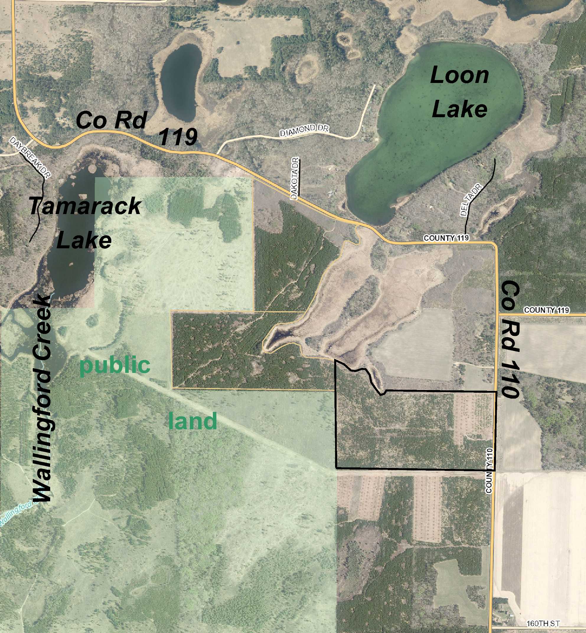
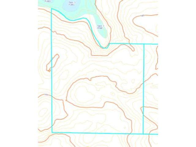
Price lowered from $138,900 to $122,500! 81+ acres of Potlatch land near Loon Lake south of Nevis and Akeley. Gently-rolling upland wooded with varying ages of red pine borders a wetland to the north. Good county road frontage less than three miles off State Hwy 64, and a trail provides access through the tract. Public land adjoins the west side and connects with the Badoura State Forest.
Main Property Info
Property ID
283100800 & 283100900
283100800 & 283100900
MLS Number
4580017
4580017
Status
Sold
Sold
List Price
$122,500
$122,500
Selling Price
$111,650
$111,650
Acres
81.750
81.750
Zoning
not zoned
not zoned
City
Nevis
Nevis
Township
White Oak Twp
White Oak Twp
State
MN
MN
Zip Code
56467
56467
County
Hubbard
Hubbard
Legal Description
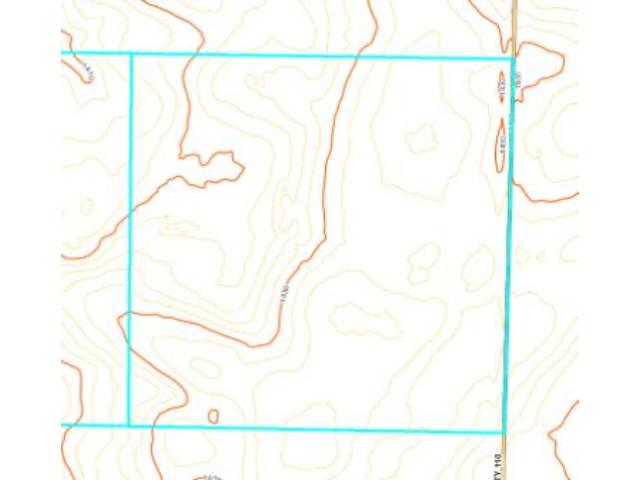
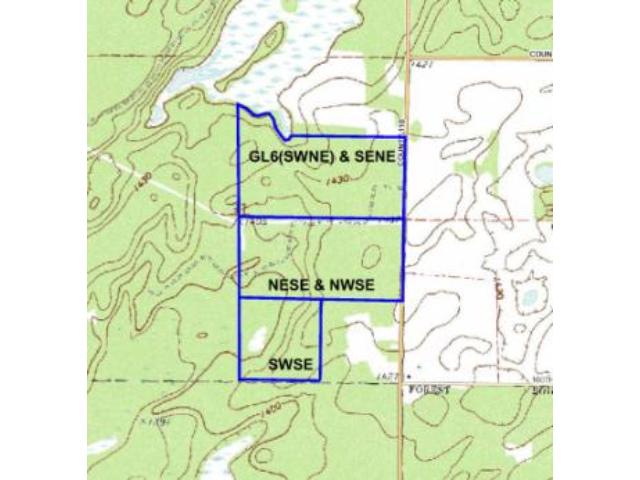
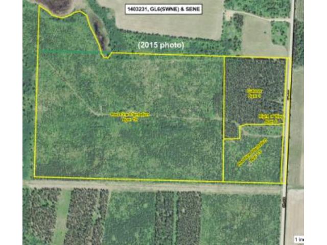
GL6(SWNE) & SENE, 31-140-32. Subject to Co Rd 110 and any easements, restrictions, or reservations of record.
GL6(SWNE) & SENE, 31-140-32. Subject to Co Rd 110 and any easements, restrictions, or reservations of record.
Property Location
Directions
From the intersection of State Hwy 64 and Co Rd 119 approx 7 miles south of Akeley, west on Co Rd 119 for 2 miles. Left(south) on Co Rd 110 for 3/8 mile to trail on right(west) entering the property.
From the intersection of State Hwy 64 and Co Rd 119 approx 7 miles south of Akeley, west on Co Rd 119 for 2 miles. Left(south) on Co Rd 110 for 3/8 mile to trail on right(west) entering the property.
Access
Good access via unpaved Co Rd 110 along the east side.
Good access via unpaved Co Rd 110 along the east side.
GPS Coordinates
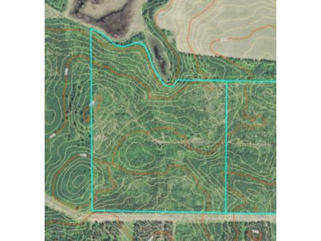
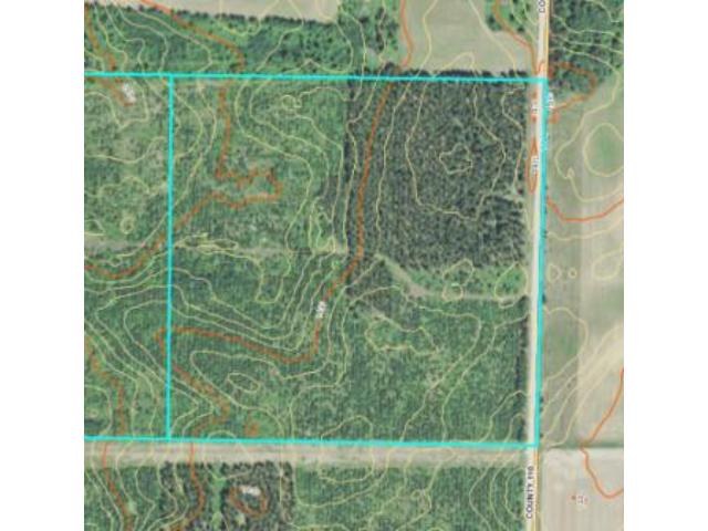
GPS coordinates to approximate corners/points based on county mapping: Point where trail off Co Rd 110 enters the east side = 46.8999, -94.7659; NE corner along Co Rd 110 = 46.9020; -94.7657; SE corner along Co Rd 110 = 46.8984, -94.7659; SW corner = 46.8985, -94.7767; point where trail exits west side = 46.9024, -94.7767; NW corner = 46.9035, -94.7767
GPS coordinates to approximate corners/points based on county mapping: Point where trail off Co Rd 110 enters the east side = 46.8999, -94.7659; NE corner along Co Rd 110 = 46.9020; -94.7657; SE corner along Co Rd 110 = 46.8984, -94.7659; SW corner = 46.8985, -94.7767; point where trail exits west side = 46.9024, -94.7767; NW corner = 46.9035, -94.7767
Address
GL6&SENE County Road 110
GL6&SENE County Road 110
School District
Walker-Hackensack-Akeley - 113
Walker-Hackensack-Akeley - 113
Property Details
Dimensions (approx)
1320x1834x2640x3104
1320x1834x2640x3104
Utilities
Available Utilities
Electric
Electric
On Site Utilities
None
None
Power Company
Itasca-Mantrap Co-op (1-888-713-3377)
Itasca-Mantrap Co-op (1-888-713-3377)
Taxes & Fees
Association Fee
$0
$0
Tax Amount
$1,070
$1,070
Tax With Assessments
$1,070
$1,070
Tax Year
2016
2016
Other Details
Section Number
31
31
Township Number
140
140
Range Number
32
32
Estimated Upland %
99
99
Estimated Wetland %
1
1
Additional Comments
Timber Comments
This property has been managed according to Forest Stewardship Council (FSC) standards. Timber includes some nice stands of varying ages of red pine plantation. If timber value is important to you, seek the advice of a competent forester to determine species, volumes and values.
This property has been managed according to Forest Stewardship Council (FSC) standards. Timber includes some nice stands of varying ages of red pine plantation. If timber value is important to you, seek the advice of a competent forester to determine species, volumes and values.
Hunting Comments
This parcel adjoins public land connecting to the Badoura State Forest in MN Firearms Deer Zone 259. Whitetail deer and bear are abundant in the area. Gently-rolling upland bordering a wetland to the north offers great tree cover and habitat for wildlife.
This parcel adjoins public land connecting to the Badoura State Forest in MN Firearms Deer Zone 259. Whitetail deer and bear are abundant in the area. Gently-rolling upland bordering a wetland to the north offers great tree cover and habitat for wildlife.
Disclosures
Power line easement may impact the southerly few feet of the property. Not surveyed; acreage and dimensions approximate based on county data and mapping; county disclaimers included by reference. Photos/maps for convenience only and not guaranteed; tree cover may be different than depicted; physically inspect prior to purchase. Any deer stands on the land are not property of seller and are not included in sale. Use seller-approved PA and addendum; closing dates the 2nd Wednesday each month.
Power line easement may impact the southerly few feet of the property. Not surveyed; acreage and dimensions approximate based on county data and mapping; county disclaimers included by reference. Photos/maps for convenience only and not guaranteed; tree cover may be different than depicted; physically inspect prior to purchase. Any deer stands on the land are not property of seller and are not included in sale. Use seller-approved PA and addendum; closing dates the 2nd Wednesday each month.


